
Scott Islands Protected Marine Area Regulations (SOR/2018-119)
Full Document:
- HTMLFull Document: Scott Islands Protected Marine Area Regulations (Accessibility Buttons available) |
- XMLFull Document: Scott Islands Protected Marine Area Regulations [25 KB] |
- PDFFull Document: Scott Islands Protected Marine Area Regulations [1359 KB]
Regulations are current to 2026-06-14 and last amended on 2018-06-27. Previous Versions
SCHEDULE / ANNEXE(Subection 2(2) / paragraphe 2(2))Map of the Flight Restriction Zone in the Protected Marine Area/Carte de la zone de restriction de vol dans la zone marine protégée
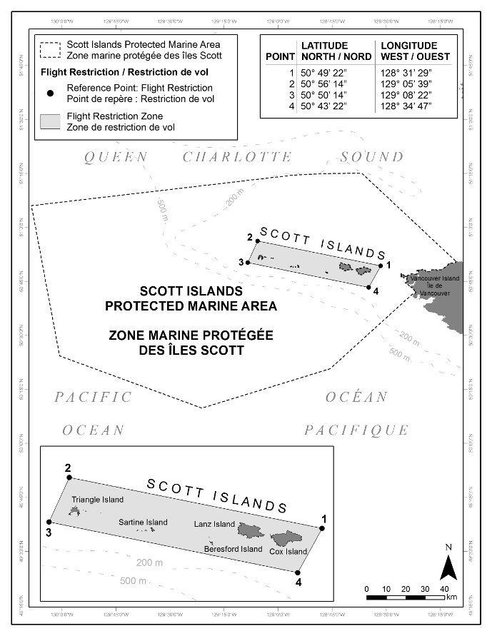
In this schedule, the lines connecting the points are rhumb lines. / Dans la présente annexe, les points sont reliés entre eux par des loxodromies.
Page Details
- Date modified: