
Northwest Territories Fishery Regulations (C.R.C., c. 847)
Full Document:
- HTMLFull Document: Northwest Territories Fishery Regulations (Accessibility Buttons available) |
- XMLFull Document: Northwest Territories Fishery Regulations [384 KB] |
- PDFFull Document: Northwest Territories Fishery Regulations [1523 KB]
Regulations are current to 2026-06-14 and last amended on 2020-04-01. Previous Versions
Table of Contents
Northwest Territories Fishery Regulations
C.R.C., c. 847
Northwest Territories Fishery Regulations
1 [Repealed, SOR/2005-108, s. 2]
Interpretation
2 (1) In these Regulations,
- Act
Act means the Fisheries Act; (Loi)
- Agreement
Agreement has the same meaning as in the Western Arctic (Inuvialuit) Claims Settlement Act; (Convention)
- angling
angling means fishing with a line to which one or more hooks are attached and that is held in the hand or attached to a rod that is held in the hand or closely attended; (pêche à la ligne)
- Area
Area means any portion of the waters described in Schedule II; (secteur)
- barbless hook
barbless hook includes a hook that has all of its barbs compressed to be in complete contact with the shaft of the hook, except those barbs on the shank that are designed solely to retain bait; (hameçon sans ardillon)
- beneficiary
beneficiary means a person who is enrolled as a beneficiary under the Agreement; (bénéficiaire)
- certificate
certificate means a registration certificate issued pursuant to section 14.1; (certificat)
- commercial fishing
commercial fishing means fishing for sale or barter; (pêche commerciale)
- commercial licence
commercial licence means a licence authorizing a person to engage in commercial fishing; (permis de pêche commerciale)
- commercial licensee
commercial licensee means a person to whom a commercial licence has been issued under the Act or these Regulations; (titulaire d’un permis de pêche commerciale)
- Department
Department means the Department of the Environment; (ministère)
- domestic fishing
domestic fishing means fishing for personal use but not for sale or barter; (pêche domestique)
- domestic fishing licence
domestic fishing licence means a licence authorizing a person to engage in domestic fishing; (permis de pêche domestique)
- explosive
explosive means a substance or device that, when detonated or fired, creates a violent shock wave in water; (explosif)
- fork length
fork length means the length of a fish measured from the tip of the nose to the centre of the fork of the tail; (longueur à la fourche)
- game fish
game fish means any fish named in Schedule I; (poisson gibier)
- gill net
gill net means a net that catches fish by enmeshing them but that does not enclose an area of water; (filet maillant)
- hook
hook means a single pointed or multiple-pointed hook on a common shaft and includes an artificial lure that has one or more hooks attached to it; (hameçon)
- Indian
Indian means an Indian as defined in the Indian Act; (Indien)
- Inuk
Inuk means a person who is a direct descendant of a person of the race of aborigines commonly known as Inuit; (Inuk)
- Inuvialuit Settlement Region
Inuvialuit Settlement Region has the same meaning as in the Agreement; (région désignée)
- Minister
Minister means the Minister of Fisheries and Oceans; (ministre)
- non-resident
non-resident means a person other than a resident Canadian; (non-résident)
- Northwest Territories resident
Northwest Territories resident means a resident Canadian who has resided continuously in the Northwest Territories for a period of,
(a) in respect of sport fishing, three months immediately preceding the day on which the person begins to fish; and
(b) in respect of commercial fishing, six months immediately preceding the day on which the person applies for a commercial fishing licence. (résident des Territoires du Nord-Ouest)
- officer
officer means a fishery officer, fishery guardian or a member of the Royal Canadian Mounted Police; (fonctionnaire)
- permanent resident
permanent resident [Revoked, SOR/93-59, s. 1]
- person of mixed blood
person of mixed blood means a person of
(a) mixed Indian and non-Indian blood who is at least one-quarter Indian, or
(b) mixed Inuk and non-Inuk blood who is at least one-quarter Inuk; (personne de sang mêlé)
- Regional Director-General
Regional Director-General means the Director-General of the Department of Fisheries and Oceans for the Central and Arctic Region; (directeur général régional)
- resident
resident [Revoked, SOR/91-481, s. 1]
- resident Canadian
resident Canadian means a person who is a Canadian citizen or a permanent resident; (résident canadien)
- snagging
snagging means fishing by impaling a fish on a hook through some part of its body instead of luring the fish to take the hook into its mouth; (casaquer)
- special management area
special management area means the waters described in an item in Schedule VIII; (secteur de gestion spécial)
- sport fish
sport fish means fish that is taken for pleasure and not for sale or barter; (poisson de sport)
- sport fishing
sport fishing means fishing for pleasure and not for sale or barter and includes angling, spear fishing and dip netting; (pêche sportive)
- sport fishing licence
sport fishing licence means a sport fishing licence set out in Schedule IV that authorizes a person to engage in sport fishing; (permis de pêche sportive)
- subsistence usage
subsistence usage has the same meaning as in paragraph (a) of the definition of that expression in the Agreement; (utilisation à des fins de subsistance)
- Tree River
Tree River means
(a) the waters of Coronation Gulf within 3 km of a point at 67°45′N., 111°56′W.;
(b) all the waters of Port Epworth lying between lines of latitude at 67°45′N. and at 67°41′N.;
(c) the waters of the Tree River and its tributaries lying between lines of latitude at 67°41′N. and 67°37′N.; and
(d) all other waters that flow directly into any waters described in paragraphs (a), (b) or (c). (Rivière Tree)
(2) No Area shall be regarded as including any waters described in Schedule III.
- SOR/79-485, s. 1
- SOR/81-119, s. 1
- SOR/91-428, s. 1
- SOR/91-481, s. 1
- SOR/93-59, ss. 1, 17(F)
- SOR/2003-137, s. 2
- SOR/2004-38, s. 1
- SOR/2005-108, s. 3
Application
3 (1) These Regulations apply in respect of
(a) Canadian fisheries waters in and adjacent to the Northwest Territories; and
(b) the tidal waters of the provinces of Ontario and Manitoba.
(2) These Regulations do not apply with respect to fishing and related activities carried out under the authority of a licence issued under the Aboriginal Communal Fishing Licences Regulations.
- SOR/93-59, s. 2
- SOR/2002-225, s. 1
General
4 The Minister may issue a licence or certificate set out in column I of an item of Schedule IV on payment of the appropriate fee, if any, set out in column II of that item.
- SOR/93-59, s. 2
4.1 The licences referred to in paragraphs (c.1) and (e.1) of item 3 of Schedule IV are not valid in Nunavut waters.
5 (1) No person shall fish except under the authority of a licence issued under these Regulations or under the Aboriginal Communal Fishing Licences Regulations.
(2) to (5) [Revoked, SOR/93-59, s. 3]
(6) No person shall fish in any lake that has been stocked with game fish except by angling.
(7) No person shall fish in any waters set out in Column I of an item of Schedule VII for the species of fish set out in Column II of that item by the method set out in Column IV of that item during the close time set out in Column III of that item.
(8) No person shall fish in the waters of Fish Creek at 67°43′42″ north latitude and 136°15′44″ west longitude, or in the waters of the Big Fish River at 68°39′48″ north latitude and 135°52′35″ west longitude, including all their tributaries, except for educational or scientific purposes under the authority of a licence.
- SOR/78-519, s. 1
- SOR/87-508, s. 1
- SOR/93-59, s. 3
- SOR/93-340, s. 1
- SOR/2009-83, s. 1
6 [Revoked, SOR/93-59, s. 4]
7 (1) No person shall catch, kill, molest or injure fish by using firearms, spears, arrows, gaffs, lights, sticks, stones, clubs, snares, dip nets or gill nets except under the authority of a licence.
(2) No person shall fish by snagging.
(3) Notwithstanding subsection (1), dip nets may be used to land fish caught by angling.
- SOR/93-59, s. 5
8 A person who erects or maintains a structure for fishing upon the ice shall remove the structure at the direction of an officer.
9 Except with the permission of an officer, no person shall leave a gill net in the water
(a) during the period from May 16th to October 31st inclusive, for more than 30 consecutive hours, or
(b) during the period from November 1st to May 15th inclusive, for more than 72 consecutive hours,
without withdrawing the net from the water and removing the fish therefrom.
10 (1) No person shall dispose of dead fish or any remains or offal of fish by leaving it in the water or on ice over the water.
(2) When gurry grounds have been designated or defined by an officer, a person who has in his possession dead or decaying fish or remnants thereof or other refuse from fishing shall place that fish, remnants or refuse in the gurry ground.
Stream Crossings
11 (1) No person shall construct a temporary crossing over any ice-covered stream, unless he
(a) uses snow or adds to the thickness of the ice by the use of snow or ice, or
(b) is authorized by an officer.
(2) [Revoked, SOR/93-59, s. 6]
- SOR/93-59, s. 6
Logging and Gravel Removal
12 (1) Where, in the opinion of the Minister, the fishery in any waters would be harmed by any of the following operations:
(a) placing logs in or releasing logs into those waters,
(b) driving, towing or booming logs in those waters,
(c) removing gravel from or displacing gravel in any spawning grounds in those waters, or
(d) any similar operation,
he may authorize the placing of signs at appropriate places on the shore designating those waters as waters in respect of the fishery of which that operation is harmful.
(2) Where, pursuant to subsection (1), any waters have been designated in respect of any operation referred to therein, no person shall carry on any such operation in those waters.
Commercial Fishing
13 (1) No person shall be issued a commercial licence to fish in the waters of Lac la Martre unless that person has resided continuously in the settlement of Lac la Martre for a period of not less than six months immediately preceding the day he applies for that licence.
(2) No person shall be issued a commercial licence to fish in the waters of Kakisa Lake unless that person has resided continuously in the settlement of Kakisa Lake for a period of not less than six months immediately preceding the day he applies for that licence.
14 [Revoked, SOR/93-59, s. 7]
14.1 (1) No person shall operate, for the purpose of commercial fishing on Great Slave Lake, a vessel or vehicle unless he is the holder of a valid commercial fishing licence and unless the vessel or vehicle has been registered by the Department for that purpose and a registration certificate bearing a registration number has been issued in respect of that vessel or vehicle.
(2) A Class A certificate may be issued only in respect of
(a) a vessel of more than 900 kg gross weight, when weighed with its attached mechanical equipment; or
(b) a vehicle of more than 900 kg gross weight.
(3) A Class B certificate may be issued in respect of vessels or vehicles other than those referred to in subsection (2).
(4) The holder of a certificate issued in respect of a vessel shall not permit the vessel to be operated in commercial fishing, unless the holder of a commercial fishing licence is on board.
(5) No person shall use a vehicle in fishing under subsection (1) unless the registration number issued under these Regulations in respect of that vehicle is painted on the vehicle or securely affixed to it by some other means and meets the requirements set out in subsection (5.1).
(5.1) A registration number referred to in subsection (5) shall be
(a) legible and unobstructed;
(b) in solid Arabic numerals of at least 15 cm in height that are without ornamentation;
(c) of a colour that contrasts with the background; and
(d) aligned horizontally.
(6) No person shall work on or fish from a vessel or vehicle engaged in commercial fishing on Great Slave Lake unless he is the holder of a commercial fishing licence or a helper’s licence.
(7) No person shall dump from a vehicle that is used in commercial fishing any fish that has been caught in accordance with these Regulations.
- SOR/79-485, s. 2
- SOR/81-468, s. 1
- SOR/93-59, s. 8
14.2 (1) In this section, registration means,
(a) in reference to a vessel, registration under the Canada Shipping Act; and
(b) in reference to a vehicle, registration under the Ordinances of the Northwest Territories.
(2) Every person who applies for a certificate in respect of a vessel or vehicle shall state
(a) the name, the registration or serial number and the size of the vessel or vehicle;
(b) the name of the owner and operator of the vessel or vehicle; and
(c) information relating to all auxiliary vessels or vehicles to be used in conjunction with the vessel or vehicle.
- SOR/79-485, s. 2
14.3 [Revoked, SOR/93-59, s. 9]
15 (1) [Revoked, SOR/93-59, s. 10]
(2) Every net used in commercial fishing and every gang of nets so used shall be marked at each end
(a) during open water fishing, by a flag that is not less than 45 cm square supported by a buoy; and
(b) during winter fishing, by a stake the top of which is at least 1 m above the surface of the water or ice.
- SOR/79-485, s. 3
- SOR/81-468, s. 2
- SOR/93-59, s. 10
16 The web of a gill net used for commercial fishing shall not be hung on any portion of the cork line of the net at a ratio greater than 2 m of web to 1 m of cork line and no additional nets shall be hung on, added to or inserted in the web of the net to increase that ratio at any place in the net.
- SOR/81-468, s. 3
17 (1) No person shall fish for commercial purposes except in waters set out in Schedule V.
(2) No person shall fish for commercial purposes in waters set out in Schedule III.
18 (1) No person shall fish in any waters set out in Column I of an item of Schedule V for any species of fish set out in Column II of that item,
(a) unless the person uses a gill net having a mesh size not less than that set out in Column III of that item, where applicable; or
(b) during the closed season set out in Column IV of that item.
(2) For the purpose of subsection (1) or any licence condition, the mesh size of a net shall be determined by measuring the distance between the extreme angles of a single mesh inside and between the knots after the twine has been immersed in water for at least 30 minutes and extended until straight without stretching or straining the twine or slipping a knot.
(3) The measurement referred to in subsection (2) shall be made by means of a measuring device certified under the Weights and Measures Act.
- SOR/98-388, s. 1
19 (1) No person shall fish in the waters set out in column I of an item of Schedule V after the time specified in a notice issued by the Regional Director-General or a fishery officer stating that the quota set out in column V of that item has been or is about to be reached.
(2) A notice referred to in subsection (1) shall be brought to the attention of the persons affected or likely to be affected by it by one or more of the methods set out in subsection 7(1) of the Fishery (General) Regulations.
- SOR/78-369, s. 1
- SOR/81-119, s. 4
- SOR/93-59, s. 11
20 For the purpose of calculating the quotas for the water areas of Great Slave Lake, each annual quota shall commence on November 1st and end on October 31st next following.
21 No person shall set a net or running line in any waters at any time during the closed season for those waters.
Native and Domestic Fishing
22 (1) Notwithstanding subsections 5(1) and 7(1), an Indian, Inuk or person of mixed blood may fish without a licence by angling or by means of gill nets, set lines, spears, snares or dip nets, for food for himself, his family or his dogs.
(2) No person shall give any fish caught under the authority of subsection (1) to any person other than an Indian, Inuk or person of mixed blood.
(3) No person, other than an Indian, Inuk or person of mixed blood, shall accept or be in possession of any fish caught under the authority of subsection (1).
(4) [Revoked, SOR/93-59, s. 12]
- SOR/81-119, s. 5
- SOR/93-59, ss. 12, 17(F)
22.1 (1) Notwithstanding subsections 5(1) and 7(1), a beneficiary may fish for subsistence usage within the Inuvialuit Settlement Region without a licence.
(2) Notwithstanding subsection 5(4) and subject to section 12 of the Agreement, a beneficiary may sell to or trade or barter with
(a) other beneficiaries, fish or any portions thereof taken for subsistence usage within the Inuvialuit Settlement Region; and
(b) any other person, the non-edible by-products of fish taken from the Inuvialuit Settlement Region for personal use.
(3) No person other than a beneficiary shall possess any edible portions of fish taken for subsistence usage from the Inuvialuit Settlement Region.
- SOR/91-481, s. 2
23 A domestic fishing licence may be issued to a person who
(a) has resided in the Northwest Territories for at least two years;
(b) needs fish for food for himself or his family; or
(c) needs fish for food for his dogs.
- SOR/79-485, s. 4
- SOR/93-59, s. 13
24 [Revoked, SOR/93-59, s. 13]
25 Every person who is the holder of a domestic fishing licence shall, upon request by an officer, state the area or areas in which he fished and the species and number of kilograms of fish taken by him during the term of the licence.
- SOR/81-468, s. 4
26 An officer may mark for identification purposes any fish caught by any person in domestic fishing.
Sport Fishing
27 (1) Notwithstanding subsection 5(1) and subject to subsection (2), a person may engage in sport fishing without a sport fishing licence if the person is
(a) a Northwest Territories resident or a resident Canadian under the age of 16 years or 65 years of age or over; or
(b) a non-resident under the age of 16 years who is accompanied by a person who holds a sport fishing licence.
(2) No person shall engage in sport fishing
(a) in a special management area without
(i) a sport fishing licence, and
(ii) a special management area fishing licence which has been validated for that special management area; or
(b) in the Inuvialuit Settlement Region without a sport fishing licence which has been validated for the Inuvialuit Settlement Region.
- SOR/91-481, s. 3
28 (1) Subject to section 38, no person angling or spear-fishing in the waters set out in column II of an item of Schedule VI shall catch and retain in any one day more fish of a species set out in column I of that item than the number set out in column III of that item.
(2) [Revoked, SOR/93-59, s. 14]
(3) [Revoked, SOR/87-508, s. 2]
- SOR/79-485, s. 5
- SOR/81-119, s. 6
- SOR/87-508, s. 2
- SOR/91-428, s. 2
- SOR/93-59, s. 14
29 (1) Subject to section 38, no person shall have in their possession at any time more fish of a species set out in column I of Schedule VI taken from the waters set out in column II than the number set out in column IV.
(2) For the purposes of subsection (1) and subsection 28(1), where a fish has been filleted, two fillets shall be regarded as one fish.
(3) Subject to subsection 38(3), no person shall have in his possession any fish taken by sport fishing at any place other than his permanent residence or transport any such fish unless the fish are
(a) whole;
(b) eviscerated; or
(c) filleted with the skin attached.
(4) For the purposes of paragraph (3)(c), fillets shall be separated before being frozen so that the number of fish can be readily determined.
(5) No person shall place, or permit to be placed, in a storage facility any fish taken by sport fishing unless such fish are identified by the name and the sport fishing licence number of the person who caught them.
- SOR/79-485, s. 6
- SOR/91-428, s. 3
- SOR/2003-137, s. 3
30 No person shall engage in sport fishing while employed as a guide by a person engaged in fishing.
31 (1) No person shall, in any year, sportfish in the Tree River after notice is given by a fishery officer that 700 arctic char have been taken from that river in that year.
(2) No person fishing in the waters of the Tree River shall take away or cause to be taken away from those waters more than two arctic char during any fishing trip.
(3) Subsections (1) and (2) do not apply to an Indian, Inuk or person of mixed blood.
(4) A notice referred to in subsection (1) shall be brought to the attention of the persons affected or likely to be affected by it by one or more of the methods set out in subsection 7(1) of the Fishery (General) Regulations.
- SOR/81-119, s. 7
- SOR/91-428, s. 4
- SOR/93-59, s. 15
32 (1) No person shall engage in spear fishing except while swimming and under authority of a sport fishing licence.
(2) [Repealed, SOR/2003-137, s. 4]
(3) All spears used in spear fishing shall be fastened to the spear gun or to the person operating the spear by a line of adequate strength to withstand without breaking any strain that is likely to be placed on the line while the gun is being operated.
(4) The shaft of every spear referred to in subsection (3) shall be fastened to the spear gun or the person using the spear by a line not exceeding 5 m in length.
(5) No person shall use, as a propellant in a spear gun, any explosive charge or any gas contained in a bottle or cartridge.
- SOR/81-468, s. 5
- SOR/2003-137, s. 4
33 No person shall use or be in possession of a gaff while sport fishing.
- SOR/78-369, s. 2
34 (1) Notwithstanding subsection 7(1) but subject to subsection (2), no person shall use a dip net having a hoop width greater than 1 m in fishing for cisco and suckers.
(2) Any fish of a species other than ciscos and suckers taken by means of a dip net shall be returned to the water immediately.
- SOR/79-485, s. 7
- SOR/81-468, s. 6
- SOR/93-59, s. 17(F)
35 No person shall, while sport fishing,
(a) fish in open water with more than a single line or rod and line;
(b) fish through the ice with more than two lines or two rods with lines attached;
(c) have more than two hooks attached to a line; or
(d) leave any line with hooks attached unattended.
36 No person shall engage in sport fishing in ice-covered water if he is more than 50 m from his line.
- SOR/81-468, s. 7
37 No person shall, when sport fishing, use any live fish for bait.
- SOR/79-485, s. 8
37.1 (1) No person engaged in angling shall use or possess a hook that is attached to the end of a fishing line if the hook is not a barbless hook.
(2) Subsection (1) does not apply to angling in Nunavut waters.
- SOR/2004-38, s. 2
- SOR/2005-108, s. 4
Size Limits
38 (1) No person shall have in his possession
(a) any arctic grayling that is less than 36 cm fork length, or
(b) more than one northern pike that is more than 90 cm fork length
taken from that portion of the Mackenzie River and tributary streams lying between 116° west longitude and 118° west longitude.
(2) No person shall
(a) possess more than one lake trout that is longer than 70 cm fork length taken from Stark Lake or Great Slave Lake, including all tributary streams from their mouths to 1 km upstream; or
(b) remove from the area referred to in paragraph (a) more than two lake trout.
(3) No person shall, on or adjacent to the waters described in subsection (1), have in his possession any Arctic grayling from which the head and tail have been removed unless the length of any such fish has been checked by a fishery officer before the head and tail were removed.
(4) No person shall
(a) possess more than two lake trout taken from the waters of the special management area described in item 1 of Schedule VIII; or
(b) remove from the area referred to in paragraph (a) more than one lake trout.
- SOR/79-485, s. 9
- SOR/81-468, s. 8
- SOR/91-481, s. 4
- SOR/2003-137, s. 5
39 [Revoked, SOR/93-59, s. 16]
SCHEDULE I(Section 2)
Species of Game Fish
| Item | Common Name | Scientific Name |
|---|---|---|
| 1 | Arctic Char | Salvelinus alpinus |
| 2 | Arctic Cisco | Coregonus autumnalis |
| 3 | Arctic Grayling | Thymallus arcticus |
| 4 | Broad Whitefish | Coregonus nasus |
| 5 | Brook Trout | Salvelinus fontinalis |
| 6 | Bull Trout | Salvelinus confluentus |
| 7 | Burbot | Lota lota |
| 8 | Dolly Varden | Salvelinus malma |
| 9 | Goldeye | Hiodon alosoides |
| 10 | Inconnu | Stenodus leucichthys |
| 11 | Lake Cisco | Coregonus artedii |
| 12 | Lake Trout | Salvelinus namaycush |
| 13 | Lake Whitefish | Coregonus clupeaformis |
| 14 | Least Cisco | Coregonus sardinella |
| 15 | Longnose Sucker | Catostomus catostomus |
| 16 | Northern Pike | Esox lucius |
| 17 | Rainbow Trout | Salmo gairdneri |
| 18 | Round Whitefish | Prosopium cylindraceum |
| 19 | Walleye | Stizostedion vitreum vitreum |
| 20 | White Sucker | Catostomus commersoni |
- SOR/78-369, s. 3
- SOR/79-485, s. 11
- SOR/81-119, s. 9
- SOR/2004-38, ss. 3, 4
- SOR/2005-108, s. 5
SCHEDULE II(Section 2)
PART IAreas of Great Slave Lake
Area I (West)
That portion of Great Slave Lake lying
(a) east of a line drawn from Point Desmarais in 61°00′48 north latitude and 116°28′12 west longitude to a point on Big Island in 61°05′18 north latitude and 116°30′06 west longitude; THENCE to a point on Big Island in 61°11′06 north latitude and 116°39′24 west longitude; and THENCE to a point in 61°12′26 north latitude and 116°41′06 west longitude; and
(b) west of a line drawn from Point de Roche to Slave Point.
Area I (East)
That portion of Great Slave Lake lying east of a line drawn from Point de Roche to Slave Point and west of a line drawn from Jones Point in 61°27′ north latitude and 115°43′ west longitude to Sulphur Point in 60°56′ north latitude and 114°49′ west longitude.
Area II
That portion of Great Slave Lake lying north and east of Area I (East) and south and west of a line drawn from the mouth of the north branch of the Jean River in 61°22′ north latitude and 113°33′ west longitude to the most northerly tip of Hardisty Island in 61°45′ north latitude and 114°37′ west longitude and THENCE to a fishing boundary marker on the mainland, and north of a straight line drawn between the mouth of the north branch of the Jean River and Slave Point to where the said line intersects the east boundary of Area I (East).
Area III
That portion of Great Slave Lake lying east of Area I (East) and south of Area II.
Area IV
That portion of Great Slave Lake lying between Area II and Water Area V.
Area V
That portion of Great Slave Lake lying east of the meridian of 113°30′00 west longitude and west of a line drawn from a point on the mainland in 62°04′43 north latitude 112°30′00 west longitude to a point on the north shore of Blanchette Island in 62°01′45 north latitude and 112°30′00″ west longitude, THENCE along the north shore of Blanchette Island to the most easterly point of Blanchette Island, THENCE to the most westerly point of Et Then Island, THENCE along the south shore of Et Then Island, THENCE along the south shore of Et Then Island to the most easterly point of Et Then Island THENCE due east to the mainland.
Area VI
That portion of Great Slave Lake lying east and north of Area V.
PART IIAreas of the Mackenzie River Delta and Lower Mackenzie River
Area I
That portion of the Mackenzie Delta bounded
(1) in the east by the west bank of the Middle Channel from the point at 67°41.5′ north latitude, 134°32.8′ west longitude to the point on the west bank of the Middle Channel at 68°13′ north latitude, 134°28′ west longitude;
(2) in the north by the parallel of latitude at 68°13′ north from the point on the west bank of the Middle Channel at 134°28′ west longitude to the point on the west bank of the Husky Channel at 135°06′ west longitude;
(3) in the west by the west bank of the Husky Channel from the point at 68°13′ north latitude, 135°06′ west longitude to the point where the Husky Channel meets the Peel River at 67°37′ north latitude, 134°52′ west longitude; and
(4) in the south by the south bank of the Peel River from the point at 67°37′ north latitude, 134°52′ west longitude to the point on the west bank of the Middle Channel at 67°41.5′ north latitude, 134°32.8′ west longitude.
Area II
That portion of the Mackenzie Delta bounded
(1) in the east by the east bank of the East Channel from the point at Point Separation at 67°37′ north latitude, 134°05′ west longitude to the point at 68°13′ north latitude, 133°47′ west longitude;
(2) in the north by the parallel of latitude at 68°13′ north from the point on the east bank of the East Channel at 133°47′ west longitude to the point on the west bank of the Middle Channel at 134°28′ west longitude;
(3) in the west by the west bank of the Middle Channel from the point at 68°13′ north latitude, 134°28′ west longitude to the point opposite Point Separation at 67°37′ north latitude, 134°10′ west longitude; and
(4) in the south by the parallel of latitude extending across the Mackenzie River at 67°37′ north from the point at 134°10′ west longitude to the point at Point Separation at 134°05′ west longitude.
Area III
That portion of the Mackenzie Delta bounded
(1) in the east by the west bank of the Middle Channel from the point at 68°13′ north latitude, 134°28′ west longitude to the junction of the Raymond Channel and the Middle Channel at 68°15.5′ north latitude, 134°25′ west longitude, then by the west bank of the Raymond Channel to the junction of the Raymond Channel and Napoiak Channel at 68°26′ north latitude, 134°24′ west longitude, then by the west bank of the Napoiak Channel to the point at the mouth of the Napoiak Channel at Shallow Bay at 68°41′ north latitude, 135°14′ west longitude, then by a line through Shallow Bay to the point at 68°59.5′ north latitude, 136°27′ west longitude;
(2) in the west by the meridian at 136°27′ west longitude from the point at 68°59.5′ north latitude to the Moose Channel at 68°44′ north latitude; then by the south bank of the Moose Channel to the point at the junction of the Moose Channel and the West Channel at 68°39′ north latitude, 135°45′ west longitude, then by the west bank of the West Channel to the community of Aklavik at 68°13′ north latitude, 135°00′ west longitude, then by the west bank of the Husky Channel to the point at 68°13′ north latitude, 135°06′ west longitude; and
(3) in the south by the parallel of latitude at 68°13′ north from the point on the west bank of the Husky Channel at 135°06′ west longitude to the point on the west bank of the Middle Channel at 134°28′ west longitude.
Area IV
That portion of the Mackenzie Delta bounded
(1) in the east by the east bank of the East Channel from the point at 68°13′ north latitude, 133°47′ west longitude to the Beaufort Sea, then by the coast of the Beaufort Sea to the point at 69°38′ north latitude, 132°54′ west longitude, then by the meridian at 132°54′ west longitude to the extent of the territorial sea of Canada as defined in subsection 3(1) of the Territorial Sea and Fishing Zones Act;
(2) in the north by the extent of the territorial sea of Canada as defined in subsection 3(1) of the Territorial Sea and Fishing Zones Act from the meridian at 132°54′ west longitude to the meridian at 136°27′ west longitude;
(3) in the west by the meridian at 136°27′ west longitude from the extent of the territorial sea of Canada as defined in subsection 3(1) of the Territorial Sea and Fishing Zones Act to the point at 68°59.5′ north latitude, then by a line through Shallow Bay to the point at 68°41′ north latitude, 135°14′ west longitude at the mouth of the Napoiak Channel, then by the west bank of the Napoiak Channel to the junction of the Napoiak Channel and the Raymond Channel at 68°26′ north latitude, 134°24′ west longitude, then by the west bank of the Raymond Channel to the junction of the Raymond Channel and the Middle Channel at 68°15.5′ north latitude, 134°25′ west longitude, then by the west bank of the Middle Channel to the point at 68°13′ north latitude, 134°28′ west longitude; and
(4) in the south by the parallel of latitude at 68°13′ north from the point on the west bank of the Middle Channel at 134°28′ west longitude to the point on the east bank of the East Channel at 133°47′ west longitude.
Area V
1 That portion of the Mackenzie River bounded
(1) in the north by the parallel of latitude across the River at Point Separation at 67°37′ north latitude from the point at 134°05′ west longitude to the point at 134°10′ west longitude; and
(2) in the south by the meridian of longitude at 128°49′ west extending across the River at the confluence of the Mountain River at 65°41′ north latitude.
2 Also that portion of the Arctic Red River from its confluence with the Mackenzie River to the point 16 km upstream at 67°19′ north latitude, 133°42′ west longitude.
Area VI
That portion of the Mackenzie River Delta bounded:
(1) in the east by a straight line joining a point at 68°40′ north latitude and 135°45′ west longitude to a point at 68°53′ north latitude and 135°45′ west longitude,
(2) in the north by a straight line joining a point at 68°53′ north latitude and 135°45′ west longitude to a point at 68°53′ north latitude and 136°27′ west longitude,
(3) in the west by a straight line joining a point at 68°53′ north latitude and 136°27′ west longitude to a point at 68°44′ north latitude and 136°27′ west longitude, and
(4) in the south by a straight line joining a point at 68°44′ north latitude and 136°27′ west longitude to a point at 68°38.5′ north latitude and 136°03′ west longitude, on the north bank of the Big Fish River and THENCE by the north bank of the Big Fish River from that point at 68°38.5′ north latitude and 136°03′ west longitude to the junction of the Big Fish River and Little Moose Channel and THENCE by a straight line across the mouth of the Big Fish River from the junction of the Big Fish River and Little Moose Channel to a point at 68°40′ north latitude and 135°52′ west longitude and THENCE by a straight line joining that point at 68°40′ north latitude and 135°52′ west longitude to a point at 68°40′ north latitude and 135°45′ west longitude.
- SOR/78-720, s. 1
- SOR/81-119, s. 10
- SOR/81-468, s. 9
- SOR/87-508, ss. 3 to 5
- SOR/91-481, s. 5
SCHEDULE III(Sections 2 and 17)
PART IWaters Areas of Great Slave Lake Not Included in Areas Described in Schedule II
1 Waters within 8 km of the shore between a line drawn 360° true from Point de Roche in 60°53′ north latitude and 116°07′ west longitude and a line drawn 360° true from Fish Point in 60°50′ north latitude and 115°22′ west true longitude.
2 Waters within
(a) 16 km of the settlement of Resolution; or
(b) 8 km of the settlement of Trout Rock in 62°27′ north latitude and 114°58′ west longitude.
(c) [Repealed, SOR/2004-38, s. 5]
3 Waters lying north and west of a line drawn across the North Arm from Whitebeach Point in 62°28′ north latitude and 115°16′ west longitude, to a point on the mainland at 62°31′ north latitude and 115°13′ west longitude.
4 Waters of Yellowknife Bay north of a line drawn from the northernmost tip of Ruth Island (62°19′ north latitude and 114°14′ west longitude) in a westerly direction to the northernmost tip of Inner Island (62°18′ north latitude and 114°18′ west longitude) THENCE in a westerly direction to an island at 62°19′ north latitude and 114°27′ west longitude and THENCE in a northwesterly direction to a point on the mainland at 62°21′ north latitude and 114°30′ west longitude.
5 All of the waters of Great Slave Lake lying east and north of Area V including the waters of Stark Lake and the river connecting Stark Lake and Great Slave Lake.
PART IIWater Areas Closed to Commercial Fishing
1 Waters of Rankin Inlet within 8 km of the mouth of the Diana River at 62°50′ north latitude and 92°24′ west longitude.
2 Waters of Prairie Bay in Rankin Inlet within 8 km of the mouth of the Meliadine River at 62°52′ north latitude and 92°06 west longitude.
- SOR/81-468, s. 10
- SOR/83-503, s. 1
- SOR/2004-38, s. 5
SCHEDULE IV(Section 4)
Licences, Validation Stamps and Certificate
| Column I | Column II | |
|---|---|---|
| 1 | Commercial fishing licence | |
| $ 5.00 | |
| No fee | |
| 10.00 | |
| 2 | Domestic fishing licence | |
| No fee | |
| 10.00 | |
| 3 | Sport fishing licence | |
| 10.00 | |
| 20.00 | |
| 15.00 | |
| 10.00 | |
| 40.00 | |
| 30.00 | |
| 10.00 | |
| No fee | |
| No fee | |
| 3.1 | Special management area fishing licence | |
| No fee | |
| 9.00 | |
| 3.2 | Validation of a licence for a special management area | |
| No fee | |
| 1.00 | |
| 3.3 | Validation of a licence for the Inuvialuit Settlement Region | No fee |
| 4 | Commercial fishing vessel or vehicle certificate for Great Slave Lake | |
| 50.00 | |
| 25.00 | |
| 5 | Helper’s Licence for Great Slave Lake | No fee |
- SOR/79-485, s. 12
- SOR/81-119, s. 11
- SOR/81-274, s. 1
- SOR/91-481, s. 6
- SOR/2019-114, s. 2
SCHEDULE V(Sections 17, 18 and 19)
Species, Mesh Sizes, Closed Seasons and Quotas for Commercial Fishing
| Column I | Column II | Column III | Column IV | Column V | |
|---|---|---|---|---|---|
| Waters | Species | Mesh Size (in millimetres) | Closed Seasons | Quota — (in Kilograms round weight) | |
| REGION I — MACKENZIE DELTA | |||||
| 1 | Alfred Lake (65-34N, 126-33W) | Whitefish and Trout | 139 | August 15 to October 15 | 2,800 |
| 2 | Akyuk Lake (70-04N, 127-10W) | Whitefish and Trout | 139 | September 1 to October 31 | 700 |
| 3 | Billy Lake (69-10N, 124-08W) | Arctic char (landlocked) | 63 | September 1 to October 31 | 5,400 |
| 4 | Biname Lake (69-04N, 124-35W) | Arctic char (landlocked) | 63 | September 1 to October 31 | 8,200 |
| 5 | Brackett Lake (65-13N, 125-20W) | Whitefish and Trout | 139 | August 15 to October 15 | 2,800 |
| 6 | Cape Parry Area (69-30N, 124-45W) | Cod | 139 | September 1 to October 31 | 11,400 |
| Herring | 63 | June 1 to June 30 | 20,000 | ||
| Whitefish and Trout | 139 | September 1 to October 31 | 300 | ||
| 7 | Doris Lake (65-10N, 128-15W) | Whitefish and Trout | 139 | August 15 to October 15 | 300 |
| 8 | Eskimo (Husky) Lake (69-20N, 132-30W) | Whitefish | 139 | September 1 to October 31 | 11,400 |
| Cisco | 63 | September 1 to October 31 | 11,400 | ||
| Lake trout | 139 | September 1 to October 31 | 11,400 | ||
| Inconnu | 139 | September 1 to October 31 | 1,200 | ||
| 9 | Hornaday River (69-20N, 123-45W) | Arctic char (searun) | 139 | August 15 to October 15 | 6,800 |
| 10 | Lennie Lake (65-34N, 126-33W) | Whitefish | 139 | August 15 to October 15 | 2,800 |
| 11 | Liverpool Bay (69-45N, 130-00W) | Herring | 63 | June 1 to June 30 | 20,000 |
| Cisco | 63 | September 1 to October 31 | 11,400 | ||
| Inconnu | 139 | September 1 to October 31 | 1,200 | ||
| 12 | Mackenzie River Delta Area I | Whitefish | 139 | May 15 to June 15 | 2,300 |
| Arctic char | 139 | August 7 to September 15 | 900 | ||
| Lake trout | 139 | May 15 to June 15 | 2,300 | ||
| Cisco | 63 | May 15 to June 15 | 2,300 | ||
| Burbot and Northern pike | 139 | May 15 to June 15 | 4,600 | ||
| 13 | Mackenzie Delta Area II | Burbot and Northern pike | 139 | May 15 to June 15 | 4,600 |
| Cisco | 63 | May 15 to June 15 | 2,300 | ||
| Whitefish | 139 | May 15 to June 15 | 9,100 | ||
| Lake trout | 139 | May 15 to June 15 | 2,300 | ||
| 14 | Mackenzie Delta Area III | Whitefish | 139 | May 15 to June 15 | 45,500 |
| Cisco | 63 | May 15 to June 15 | 2,300 | ||
| Lake trout | 139 | May 15 to June 15 | 2,300 | ||
| Burbot and Northern pike | 139 | May 15 to June 15 | 4,600 | ||
| 15 | Mackenzie Delta Area IV | Herring | 63 | May 15 to June 15 | 20,000 |
| Lake trout | 139 | May 15 to June 15 | 2,300 | ||
| Inconnu | 139 | May 15 to June 15 | 4,600 | ||
| Whitefish | 139 | May 15 to June 15 | 4,600 | ||
| 16 | Mackenzie Delta Area V | Whitefish | 139 | May 15 to June 15 | 4,600 |
| Herring | 63 | May 15 to June 15 | 500 | ||
| Cisco | 63 | May 15 to June 15 | 500 | ||
| 17 | Mahoney Lake (65-30N, 125-20W) | Whitefish and Trout | 139 | August 15 to October 15 | 4,600 |
| 18 | Manuel Lake (67-00N, 128-56W) | Whitefish and Trout | 139 | August 15 to October 15 | 800 |
| 19 | Middle Lake (70-02N, 127-02W) | Whitefish and Trout | 139 | September 1 to October 31 | 700 |
| 20 | Old Horton River (70-08N, 127-30W) | Whitefish, Trout and Arctic char | 139 | September 1 to October 31 | 900 |
| 21 | Peel River (67-37N, 134-52W) Junction of Satah R. | Whitefish | 139 | May 15 to June 15 | 2,300 |
| 22 | Reuben Lake (69-16N, 124-16W) | Arctic char (landlocked) | 63 | September 1 to October 31 | 1,600 |
| 23 | Rorey Lake (66-55N, 128-25W) | Whitefish and Trout | 139 | August 15 to October 15 | 800 |
| 24 | [Repealed, SOR/2011-194, s. 2] | ||||
| 25 | Sitidgi Lake (68-30N, 132-40W) | Whitefish and Trout | 139 | May 15 to June 15 | 300 |
| 26 | Tagatui Lake (64-57N, 125-12W) | Whitefish | 139 | August 15 to October 15 | 900 |
| 27 | Tasseriuk Lake (69-24N, 124-40W) | Arctic char (landlocked) | 63 | September 1 to October 31 | 7,200 |
| 28 | Thrasher Lake (69-16N, 124-08W) | Arctic char (landlocked) | 63 | September 1 to October 31 | 1,600 |
| 29 | Whitefish Lake (65-43N, 125-00W) | Whitefish and Trout | 139 | August 15 to October 15 | 500 |
| 30 | Unnamed Lake (69-12N, 123-50W) | Arctic char (landlocked) | 63 | September 1 to October 31 | 1,400 |
| 31 | Unnamed Lake (69-12N, 123-59W) | Arctic char (landlocked) | 63 | September 1 to October 31 | 900 |
| 32 | Unnamed Lake (69-14N, 123-45W) | Arctic char (landlocked) | 63 | September 1 to October 31 | 400 |
| 33 | Unnamed Lake (69-28N, 124-28W) | Arctic char (landlocked) | 63 | September 1 to October 31 | 3,000 |
| 34 | Unnamed Lake (69-37N, 124-20W) | Arctic char (landlocked) | 63 | September 1 to October 31 | 300 |
| REGION II — SLAVE MACKENZIE | |||||
| 1 | Beaver Lake (61-07N, 117-08W) | Whitefish and Trout | 139 | August 15 to October 15 | 20,800 |
| 2 | Bedarch Lake (60-19N, 109-57W) | Whitefish and Trout | 139 | September 1 to October 31 | 2,000 |
| 3 | Bennathy Lake (60-38N, 110-33W) | Whitefish and Trout | 139 | September 1 to October 31 | 900 |
| 4 | Blackwater Lake (64-00N, 123-05W) | Whitefish and Trout | 139 | September 1 to October 31 | 12,500 |
| 5 | Champagne Lakes (60-40N, 111-10W) | Whitefish and Trout | 139 | August 15 to October 15 | 300 |
| 6 | Deskenatlata Lake (60-55N, 112-03W) | Whitefish, Trout and Walleye | 133 | August 15 to October 15 | 3,600 |
| 7 | Disappointment Lake (60-05N, 110-27W) | Whitefish and Trout | 139 | August 15 to October 15 | 1,400 |
| 8 | Dogface (Trefiak) Lake (60-17N, 119-05W) | Walleye | 108 | April 15 to June 15 | 2,300 |
| 9 | Fork Lake (60-53N, 111-05W) | Whitefish and Trout | 139 | August 15 to October 15 | 900 |
| 10 | Gagnon Lake (62-08N, 110-27W) | Whitefish and Trout | 133 | August 15 to October 15 | 6,300 |
| 11 | Gertrude Lake (60-23N, 111-21W) | Whitefish and Trout | 139 | August 15 to October 15 | 200 |
| 11.1 | Grandin Lake (63-59N, 119-00W) | Whitefish and Trout | 133 | August 15 to October 15 | 13,000 |
| 12 | Great Slave Lake Area I (West) | Whitefish and Trout | n/a | May 15 to May 30 | 227,300 |
| 13 | Great Slave Lake Area I (East) | Whitefish and Trout | n/a | May 15 to May 30 | 318,200 |
| 14 | Great Slave Lake Area II | Whitefish and Trout | n/a | May 15 to May 30 | 318,200 |
| 15 | Great Slave Lake Area III | Whitefish and Trout | n/a | May 15 to May 30 | 45,500 |
| 16 | Great Slave Lake Area IV | Whitefish and Trout | n/a | May 15 to May 30 | 409,100 |
| 17 | Great Slave Lake Area V | Whitefish and Trout | n/a | May 15 to May 30 | 363,600 |
| 18 | Hanging Ice Lake (60-13N, 110-55W) | Whitefish and Trout | 139 | August 15 to October 15 | 700 |
| 19 | High Level Lake (60-50N, 110-39W) | Whitefish and Trout | 139 | August 15 to October 15 | 700 |
| 20 | Hjalmar Lake (61-33N, 109-25W) | Whitefish and Trout | 133 | August 15 to October 15 | 8,800 |
| 21 | Hotel Lake (60-25N, 110-05W) | Whitefish and Trout | 139 | August 15 to October 15 | 1,000 |
| 22 | Indian Shack Lake (60-39N, 111-05W) | Whitefish and Trout | 139 | August 15 to October 15 | 500 |
| 23 | Jack Lake (60-46N, 111-08W) | Whitefish and Trout | 139 | August 15 to October 15 | 300 |
| 24 | Kakisa Lake (60-55N, 117-40W) | Walleye | 108 | May 15 to May 30 | 20,000 |
| 25 | Keller Lake (64-00N, 121-25W) | Whitefish and Trout | 133 | August 15 to October 15 | 22,700 |
| 26 | King Lake (61-05N, 110-32W) | Whitefish and Trout | 139 | August 15 to October 15 | 3,000 |
| 27 | Lac La Loche (62-02N, 110-53W) | Whitefish and Trout | 133 | August 15 to October 15 | 5,200 |
| 28 | [Repealed, SOR/2011-194, s. 5] | ||||
| 29 | Largepike Lake (60-04N, 110-19W) | Whitefish and Trout | 139 | August 15 to October 15 | 1,900 |
| 30 | Leland Lake (60-00N, 110-59W) | Whitefish and Trout | 139 | August 15 to October 15 | 600 |
| 31 | McDonald Lake (62-07N, 111-13W) | Whitefish and Trout | 133 | August 15 to October 15 | 4,600 |
| 32 | McEwan Lake (60-48N, 119-57W) | Whitefish and Trout | 139 | August 15 to October 15 | 600 |
| 33 | MacInnis Lake (61-21N, 110-12W) | Whitefish and Trout | 139 | August 15 to October 15 | 2,300 |
| 34 | Margaret Lake (63-40N, 109-47W) | Whitefish and Trout | 139 | August 15 to October 15 | 5,600 |
| 35 | Mistigi Lake (60-25N, 111-47W) | Whitefish and Trout | 139 | August 15 to October 15 | 500 |
| 36 | Naskethey Lake (61-19N, 109-24W) | Whitefish and Trout | 139 | August 15 to October 15 | 1,700 |
| 37 | Naylor Lake (60-33N, 111-27W) | Whitefish and Trout | 139 | August 15 to October 15 | 300 |
| 38 | Nonacho Lake (61-42N, 109-40W) | Whitefish and Trout | 133 | August 15 to October 15 | 31,800 |
| 39 | O’Conner Lake (61-18N, 111-52W) | Whitefish and Trout | 139 | August 15 to October 15 | 2,300 |
| 40 | Oulton Lake (60-46N, 111-20W) | Whitefish and Trout | 139 | August 15 to October 15 | 1,000 |
| 41 | Piers Lake (60-20N, 111-06W) | Whitefish and Trout | 139 | August 15 to October 15 | 4,200 |
| 42 | Reade Lake (60-53N, 119-55W) | Whitefish and Trout | 139 | August 15 to October 15 | 300 |
| 43 | Robinson Lake (60-48N, 110-55W) | Whitefish and Trout | 139 | August 15 to October 15 | 600 |
| 44 | Ruelling Lake (61-22N, 109-33W) | Whitefish and Trout | 139 | August 15 to October 15 | 1,900 |
| 45 | Rutledge Lake (61-33N, 110-47W) | Whitefish and Trout | 133 | August 15 to October 15 | 9,500 |
| 46 | Salkeld Lake (61-35N, 109-50W) | Whitefish and Trout | 139 | August 15 to October 15 | 1,800 |
| 46.1 | Scott Lake (60-00N, 106-05W) | Whitefish and Trout | 139 | August 15 to October 15 | 21,000 |
| 47 | Shark Lake (60-29N, 109-32W) | Whitefish and Trout | 139 | August 15 to October 15 | 600 |
| 48 | Sibbeston Lake (61-47N, 122-43W) | Whitefish and Trout | 139 | August 15 to October 15 | 500 |
| 49 | Soulier Lake (60-41N, 110-08W) | Whitefish and Trout | 139 | August 15 to October 15 | 1,900 |
| 50 | Sparks Lake (61-12N, 109-40W) | Whitefish and Trout | 133 | August 15 to October 15 | 6,500 |
| 51 | Taltson Lake (61-30N, 110-15W) | Whitefish and Trout | 133 | August 15 to October 15 | 4,600 |
| 52 | Taltson River mouth to confluence of Rat R. (61-20N, 112-40W) | Walleye | 114 | April 15 to June 15 | 11,400 |
| 53 | Tathlina Lake (60-30N, 117-30W) | Walleye | 108 | May 15 to May 30 | 20,000 |
| 54 | Telklini Lake (60-02N, 111-15W) | Whitefish and Trout | 139 | August 15 to October 15 | 400 |
| 55 | Tetcho Lake (60-25N, 120-45W) | Whitefish and Trout | 139 | August 15 to October 15 | 1,000 |
| 56 | Thekulthili Lake (61-03N, 110-04W) | Whitefish and Trout | 133 | August 15 to October 15 | 13,800 |
| 57 | Thubun Lakes (61-34N, 111-45W) | Whitefish and Trout | 133 | August 15 to October 15 | 9,300 |
| 58 | Tourangeau Lake (60-19N, 110-31W) | Whitefish and Trout | 139 | August 15 to October 15 | 1,400 |
| 59 | Trainor Lake (60-24N, 120-17W) | Whitefish and Trout | 139 | August 15 to October 15 | 1,900 |
| 60 | Tronka Chua Lake (61-30N, 109-54W) | Whitefish and Trout | 139 | August 15 to October 15 | 1,900 |
| 61 | Trudel Lake (60-21N, 111-19W) | Whitefish and Trout | 139 | August 15 to October 15 | 200 |
| 62 | Tsetso Lake (61-51N, 123-01W) | Walleye | 114 | April 15 to June 15 | 800 |
| 63 | Vandyck Lake (60-12N, 109-28W) | Whitefish and Trout | 139 | August 15 to October 15 | 1,200 |
| 64 | Walker Lake (61-52N, 109-57W) | Whitefish and Trout | 139 | August 15 to October 15 | 600 |
| 65 | Willow Lake (62-11N, 119-10W) | Whitefish and Trout | 133 | August 15 to October 15 | 1,400 |
| 66 | Wrigley Lake (63-51N, 126-10W) | Whitefish and Trout | 133 | August 15 to October 15 | 1,700 |
| 67 | Yatsore Lake (60-46N, 110-15W) | Whitefish and Trout | 133 | August 15 to October 15 | 2,400 |
| 68 | Zinto Lake (61-06N, 116-22W) | Whitefish and Trout | 133 | August 15 to October 15 | 4,200 |
| 69 | Unnamed Lake (60-10N, 117-55W) | Whitefish and Trout | 139 | August 15 to October 15 | 1,800 |
| 70 | Unnamed Lake (60-10N, 118-10W) | Whitefish and Trout | 139 | August 15 to October 15 | 1,100 |
| 71 | Unnamed Lake (61-15N, 111-59W) | Whitefish and Trout | 139 | August 15 to October 15 | 700 |
| 72 | Unnamed Lake (61-28N, 109-35W) | Whitefish and Trout | 139 | August 15 to October 15 | 5,000 |
| 73 | Unnamed Lake (61-50N, 119-28W) | Whitefish and Trout | 139 | August 15 to October 15 | 1,700 |
| 74 | Unnamed Lake (61-51N, 119-27W) | Whitefish and Trout | 139 | August 15 to October 15 | 1,500 |
| 75 | Unnamed Lake (61-51N, 119-32W) | Whitefish and Trout | 139 | August 15 to October 15 | 800 |
| REGION III — CENTRAL INLAND | |||||
| 1 | Alcantara Lake (60-57N, 108-09W) | Whitefish and Trout | 139 | August 15 to October 15 | 2,300 |
| 2 | Angus Lake (63-27N, 111-57W) | Whitefish and Trout | 139 | August 15 to October 15 | 1,400 |
| 3 | Arseno Lake (64-34N, 115-39W) | Whitefish and Trout | 139 | August 15 to October 15 | 2,300 |
| 4 | Atzinging Lake (60-13N, 103-10W) | Whitefish and Trout | 139 | August 15 to October 15 | 6,000 |
| 5 | Bartlett Lake (63-05N, 118-20W) | Whitefish and Trout | 139 | August 15 to October 15 | 11,200 |
| 6 | Basler Lake (63-55N, 116-00W) | Whitefish and Trout | 139 | August 15 to October 15 | 6,000 |
| 7 | Belanger Lake (66-08N, 114-57W) | Whitefish and Trout | 139 | August 15 to October 15 | 600 |
| 8 | Beaverlodge Lake (64-42N, 118-12W) | Whitefish and Trout | 139 | August 15 to October 15 | 2,300 |
| 9 | Beniah Lake (63-24N, 112-17W) | Whitefish and Trout | 139 | August 15 to October 15 | 5,700 |
| 10 | Big Rocky Lake (62-19N, 102-15W) | Whitefish and Trout | 139 | August 15 to October 15 | 4,200 |
| 11 | Blaisdelle Lake (62-47N, 113-34W) | Whitefish and Trout | 139 | August 15 to October 15 | 800 |
| 12 | Blatchford Lake (62-11N, 112-35W) | Whitefish and Trout | 139 | August 15 to October 15 | 1,500 |
| 13 | Buckham Lake (62-18N, 112-37W) | Whitefish and Trout | 139 | August 15 to October 15 | 1,900 |
| 14 | Camsell Lake (63-35N, 111-15W) | Whitefish and Trout | 139 | August 15 to October 15 | 9,100 |
| 15 | [Revoked, SOR/91-428, s. 5] | ||||
| 16 | Chedabucto Lake (62-24N, 115-30W) | Whitefish and Trout | 139 | August 15 to October 15 | 2,600 |
| 17 | Chipp Lake (62-28N, 112-38W) | Whitefish and Trout | 139 | August 15 to October 15 | 4,500 |
| 18 | Crapaud Lake (62-56N, 114-01W) | Whitefish and Trout | 139 | August 15 to October 15 | 400 |
| 19 | Desperation Lake (62-35N, 112-25W) | Whitefish and Trout | 139 | August 15 to October 15 | 1,500 |
| 20 | Doran Lake (61-14N, 108-05W) | Whitefish and Trout | 139 | August 15 to October 15 | 2,900 |
| 21 | [Revoked, SOR/91-428, s. 5] | ||||
| 22 | Germaine Lake (63-13N, 114-35W) | Whitefish and Trout | 139 | August 15 to October 15 | 1,000 |
| 23 | Gordon Lake (63-10N, 113-12W) | Whitefish and Trout | 133 | August 15 to October 15 | 6,300 |
| 24 | [Revoked, SOR/91-428, s. 5] | ||||
| 25 | Grant Lake (64-54N, 116-35W) | Whitefish and Trout | 139 | August 15 to October 15 | 3,100 |
| 26 | Halliday Lake (61-21N, 108-56W) | Whitefish and Trout | 139 | August 15 to October 15 | 2,700 |
| 27 | Hardisty Lake (64-30N, 117-45W) | Whitefish and Trout | 139 | August 15 to October 15 | 18,500 |
| 28 | Helmer Lake (62-50N, 114-03W) | Whitefish and Trout | 139 | August 15 to October 15 | 700 |
| 29 | Hottah Lake (65-00N, 118-30W) | Whitefish and Trout | 133 | August 15 to October 15 | 49,200 |
| 30 | Ingray Lake (64-20N, 116-10W) | Whitefish and Trout | 133 | August 15 to October 15 | 8,600 |
| 31 | Kasba Lake (60-18N, 102-07W) | Whitefish and Trout | 139 | August 15 to October 15 | 75,900 |
| 32 | Labrish Lake (63-40N, 116-15W) | Whitefish and Trout | 139 | August 15 to October 15 | 800 |
| 33 | Lac La Martre (63-20N, 118-00W) | Whitefish and Trout | 139 | August 15 to October 15 | 45,000 |
| 34 | Little Crapeau Lake (64-50N, 116-27W) | Whitefish and Trout | 139 | August 15 to October 15 | 2,300 |
| 35 | Markham Lake (62-30N, 102-37W) | Whitefish and Trout | 139 | August 15 to October 15 | 6,500 |
| 36 | Mary Lake (62-24N, 103-31W) | Whitefish and Trout | 139 | August 15 to October 15 | 9,200 |
| 37 | Mattberry Lake (64-05N, 115-54W) | Whitefish and Trout | 139 | August 15 to October 15 | 5,400 |
| 38 | Mazenod Lake (63-42N, 117-02W) | Whitefish and Trout | 139 | August 15 to October 15 | 2,200 |
| 39 | Mackay Lake (63-55N, 110-25W) | Whitefish and Trout | 139 | August 15 to October 15 | 67,400 |
| 40 | Mosher Lake (63-06N, 115-26W) | Walleye | 114 | August 15 to October 15 | 1,100 |
| 41 | Pauline Lake (62-03N, 113-12W) | Whitefish and Trout | 139 | August 15 to October 15 | 700 |
| 42 | Plante Lake (62-31N, 113-34W) | Whitefish and Trout | 139 | August 15 to October 15 | 500 |
| 43 | Porter Lake (61-41N, 108-05W) | Whitefish and Trout | 139 | August 15 to October 15 | 6,100 |
| 44 | Prestige Lake (62-57N, 113-39W) | Whitefish and Trout | 139 | August 15 to October 15 | 500 |
| 45 | Rebesca Lake (64-32N, 116-22W) | Whitefish and Trout | 139 | August 15 to October 15 | 3,700 |
| 46 | Rivett Lake (63-18N, 111-48W) | Whitefish and Trout | 139 | August 15 to October 15 | 1,800 |
| 47 | Ross Lake (62-41N, 113-16W) | Whitefish and Trout | 133 | August 15 to October 15 | 1,800 |
| 48 | Saddle Lake (63-54N, 116-31W) | Whitefish and Trout | 139 | August 15 to October 15 | 5,100 |
| 49 | [Revoked, SOR/91-428, s. 5] | ||||
| 50 | Selwyn Lake (60-05N, 104-25W) | Whitefish and Trout | 133 | August 15 to October 15 | 22,700 |
| 51 | Slemon Lake (63-13N, 116-01W) | Whitefish and Trout | 139 | August 15 to October 15 | 2,700 |
| 52 | Sparrow Lake (62-37N, 113-40W) | Whitefish and Trout | 139 | August 15 to October 15 | 900 |
| 53 | Thistlethwaite Lake (63-10N, 113-37W) | Whitefish and Trout | 133 | August 15 to October 15 | 1,900 |
| 54 | Upper Ross Lake (62-43N, 113-08W) | Whitefish and Trout | 133 | August 15 to October 15 | 600 |
| 55 | Victory Lake (62-40N, 113-05W) | Whitefish and Trout | 139 | August 15 to October 15 | 800 |
| 56 | Wecho Lake (63-58N, 113-50W) | Whitefish and Trout | 139 | August 15 to October 15 | 6,000 |
| 57 | Wedge Lake (62-51N, 113-41W) | Whitefish and Trout | 139 | August 15 to October 15 | 600 |
| 58 | Whitefish Lake (62-41N, 106-48W) | Whitefish and Trout | 139 | August 15 to October 15 | 300 |
| 59 | Unnamed Lake (62-32N, 113-48W) | Whitefish and Trout | 139 | August 15 to October 15 | 1,000 |
| 60 | Unnamed Lake (62-45N, 114-05W) | Whitefish and Trout | 139 | August 15 to October 15 | 800 |
| 61 | Unnamed Lake (62-45N, 114-07W) | Whitefish and Trout | 139 | August 15 to October 15 | 1,400 |
| 62 | Unnamed Lake (63-16N, 116-15W) | Whitefish and Trout | 139 | August 15 to October 15 | 500 |
| REGION IV — CENTRAL ARCTIC | |||||
| 1 | Agnew River Area Ilaunnallic Bay (70-40N, 92-40W) | Arctic char (searun) | 139 | April 1 to March 31 | 4,500 |
| 2 | Arrowsmith River (68-23N, 90-17W) | Arctic char (searun) | 139 | April 1 to March 31 | 9,100 |
| 2.1 | Back River (67-15N, 95-15W) | Arctic char (searun) | 139 | April 1 to March 31 | 9,100 |
| 3 | Becher River (68-45N, 90-08W) | Arctic char (searun) | 139 | April 1 to March 31 | 4,500 |
| 4 | Buffit Lake (69-43N, 106-55W) | Whitefish and Trout | 139 | April 1 to March 31 | 1,200 |
| 5 | Casey Lake (69-37N, 107-50W) | Whitefish and Trout | 139 | April 1 to March 31 | 3,400 |
| 6 | Coppermine River (67-49N, 115-04W) | Arctic char (searun) | 139 | April 1 to March 31 | 600 |
| 7 | Curtis River (Committee Bay) (67-12N, 87-28W) | Arctic char (searun) | 139 | April 1 to March 31 | 4,500 |
| 8 | Ekalluk Lake (69-45N, 104-30W) | Whitefish and Trout | 139 | April 1 to March 31 | 9,100 |
| 9 | Ekalluk River (69-25N, 106-17W) | Arctic char (searun) | 139 | April 1 to March 31 | 14,500 |
| 10 | Ellice River (68-03N, 104-00W) | Arctic char (searun) | 139 | April 1 to March 31 | 9,100 |
| 11 | Ferguson Lake (69-25N, 105-30W) | Trout | 139 | April 1 to March 31 | 11,200 |
| 12 | Flying Horse Lake (69-47N, 105-12W) | Whitefish and Trout | 139 | April 1 to March 31 | 4,100 |
| 13 | Halovik River (30 Mi. R.) (69-10N, 107-04W) | Arctic char (searun) | 139 | April 1 to March 31 | 6,800 |
| 13.1 | Hayes River (67-08N, 95-17W) | Arctic char (searun) | 139 | April 1 to March 31 | 4,500 |
| 14 | Jayco River, Albert Edward Bay (69-34N, 103-21W) | Arctic char (searun) | 139 | April 1 to March 31 | 13,600 |
| 15 | [Revoked, SOR/91-428, s. 5] | ||||
| 16 | Kagloryuak River (70-18N, 111-24W) | Arctic char (searun) | 139 | September 1 to October 31 | 4,500 |
| 16.1 | Kaleet River (67-40N, 97-11W) | Arctic cisco | 63 | April 1 to March 31 | 1,000 |
| 17 | Keith Bay (Committee Bay) (68-15N, 88-15W) | Arctic char (searun) | 139 | April 1 to March 31 | 4,500 |
| 18 | Kellett River (68-21N, 90-07W) | Arctic char (searun) | 139 | April 1 to March 31 | 9,100 |
| 19 | Kitiga Lake (69-15N, 105-40W) | Whitefish and Trout | 139 | April 1 to March 31 | 6,400 |
| 20 | Kulgayuk River (Dease Pt.) (68-16N, 105-03W) | Arctic char (searun) | 139 | April 1 to March 31 | 11,400 |
| 21 | Kuujjuar River, Minto Inlet Area (71-16N, 116-48W) | Arctic char (searun) | 139 | September 1 to October 31 | 600 |
| 22 | Lauchlan River (Byron Bay) (68-56N, 108-30W) | Arctic char (searun) | 139 | April 1 to March 31 | 9,100 |
| 23 | Lord Lindsay Lake (70-10N, 92-25W) | Arctic char (searun) | 139 | April 1 to March 31 | 3,000 |
| 24 | Merkley Lake (69-45N, 107-40W) | Whitefish and Trout | 139 | April 1 to March 31 | 5,500 |
| 25 | Murchison River (68-35N, 93-30W) | Arctic char (searun) | 139 | April 1 to March 31 | 9,100 |
| 26 | Norway Bay River Area (71-05N, 104-33W) | Arctic char (searun) | 139 | April 1 to March 31 | 4,500 |
| 27 | Paliryuak (Surrey) River (69-27N, 106-40W) | Arctic char (searun) | 139 | April 1 to March 31 | 9,100 |
| 28 | Pangtium Lake (69-42N, 106-22W) | Whitefish and Trout | 139 | April 1 to March 31 | 1,100 |
| 29 | Perry River (67-43N, 102-10W) | Arctic char (searun) | 139 | April 1 to March 31 | 4,500 |
| 30 | Port Parry Area (69-40N, 97-20W) | Arctic char (searun) | 139 | April 1 to March 31 | 2,300 |
| 31 | Shead Lake (69-40N, 108-24W) | Whitefish and Trout | 139 | April 1 to March 31 | 4,500 |
| 32 | Simpson River (67-48N, 100-45W) | Arctic char (searun) | 139 | April 1 to March 31 | 4,500 |
| 33 | Stanwell-Fletcher Lake (72-39N, 94-41W) | Arctic char (searun) | 139 | April 1 to March 31 | 6,800 |
| 34 | Surrey Lake (69-40N, 107-13W) | Whitefish and Trout | 139 | April 1 to March 31 | 9,100 |
| 35 | Tahoe Lake (70-15N, 108-45W) | Whitefish and Trout | 139 | April 1 to March 31 | 9,100 |
| 36 | [Repealed, SOR/2011-194, s. 14] | ||||
| 37 | Toassie Lake (69-41N, 106-39W) | Whitefish and Arctic cisco | 139 | April 1 to March 31 | 900 |
| 38 | Washburn Lake (70-05N, 107-30W) | Whitefish and Trout | 139 | April 1 to March 31 | 14,500 |
| 39 | Wickware Lake (69-48N, 108-25W) | Whitefish and Trout | 139 | April 1 to March 31 | 4,100 |
| 40 | Unnamed River, east of Ellice River (67-53N, 103-07W) | Arctic char (searun) | 139 | April 1 to March 31 | 11,400 |
| 41 | Unnamed River (Dease Pt.) (68-16N, 104-58W) | Arctic char (searun) | 139 | April 1 to March 31 | 9,100 |
| 42 | Unnamed Lake (68-55N, 104-53W) | Arctic char (landlocked) | 63 | April 1 to March 31 | 800 |
| 43 | Unnamed Lake (68-57N, 104-17W) | Lake Trout, Whitefish and Arctic char (landlocked) | 139 | April 1 to March 31 | 2,700 |
| 44 | Unnamed Lake (68-57N, 104-45W) | Arctic char (landlocked) | 63 | April 1 to March 31 | 1,000 |
| 45 | Unnamed Lake (68-57N, 104-58W) | Arctic char (landlocked) | 63 | April 1 to March 31 | 500 |
| 46 | Unnamed Lake (69-00N, 104-22W) | Arctic char (landlocked) | 63 | April 1 to March 31 | 600 |
| 47 | Unnamed Lake (69-01N, 104-38W) | Arctic char (landlocked) | 63 | April 1 to March 31 | 300 |
| 48 | Unnamed Lake (69-02N, 103-17W) | Arctic char (landlocked) | 63 | April 1 to March 31 | 1,100 |
| 49 | Unnamed Lake (69-03N, 104-47W) | Arctic char (landlocked) | 63 | April 1 to March 31 | 400 |
| 50 | Unnamed Lake (69-04N, 103-01W) | Arctic char (landlocked) | 63 | April 1 to March 31 | 1,600 |
| 51 | Unnamed Lake (69-04N, 103-14W) | Arctic char (landlocked) | 63 | April 1 to March 31 | 2,200 |
| 52 | Unnamed Lake (69-04N, 103-55W) | Arctic char (landlocked) | 63 | April 1 to March 31 | 1,500 |
| 53 | Unnamed Lake (69-04N, 104-20W) | Arctic char (landlocked) | 63 | April 1 to March 31 | 1,400 |
| 54 | Unnamed Lake (69-04N, 104-47W) | Arctic char (landlocked) | 63 | April 1 to March 31 | 400 |
| 55 | Unnamed Lake (69-05N, 104-10W) | Arctic char (landlocked) | 63 | April 1 to March 31 | 1,800 |
| 56 | Unnamed Lake (69-05N, 104-40W) | Arctic char (landlocked) | 63 | April 1 to March 31 | 2,100 |
| 57 | Unnamed Lake (69-06N, 103-40W) | Arctic char (landlocked) | 63 | April 1 to March 31 | 800 |
| 58 | Unnamed Lake (69-06N, 104-00W) | Arctic char (landlocked) | 63 | April 1 to March 31 | 500 |
| 59 | Unnamed Lake (69-06N, 104-40W) | Arctic char (landlocked) | 63 | April 1 to March 31 | 2,100 |
| 60 | Unnamed Lake (69-07N, 104-50W) | Arctic char (landlocked) | 63 | April 1 to March 31 | 300 |
| 61 | Unnamed Lake (69-09N, 102-57W) | Arctic char (landlocked) | 63 | April 1 to March 31 | 2,600 |
| 62 | Unnamed Lake (69-09N, 104-10W) | Arctic char (landlocked) | 63 | April 1 to March 31 | 400 |
| 63 | Unnamed Lake (69-09N, 104-42W) | Arctic char (landlocked) | 63 | April 1 to March 31 | 500 |
| 64 | Unnamed Lake (69-09N, 105-20W) | Arctic char (landlocked) | 63 | April 1 to March 31 | 800 |
| 65 | Unnamed Lake (69-11N, 103-55W) | Arctic char (landlocked) | 63 | April 1 to March 31 | 500 |
| 66 | Unnamed Lake (69-11N, 105-24W) | Arctic char (landlocked) | 63 | April 1 to March 31 | 1,400 |
| 67 | Unnamed Lake (69-12N, 103-50W) | Arctic char (landlocked) | 63 | April 1 to March 31 | 1,500 |
| 68 | Unnamed Lake (69-12N, 104-44W) | Arctic char (landlocked) | 63 | April 1 to March 31 | 1,100 |
| 69 | Unnamed Lake (69-14N, 103-31W) | Arctic char (landlocked) | 63 | April 1 to March 31 | 700 |
| 70 | Unnamed Lake (69-14N, 104-05W) | Arctic char (landlocked) | 63 | April 1 to March 31 | 3,200 |
| 71 | Unnamed Lake (69-14N, 105-18W) | Arctic char (landlocked) | 63 | April 1 to March 31 | 1,400 |
| 72 | Unnamed Lake (69-15N, 104-35W) | Arctic char (landlocked) | 63 | April 1 to March 31 | 1,000 |
| 73 | Unnamed Lake (69-15N, 104-44W) | Arctic char (landlocked) | 63 | April 1 to March 31 | 1,400 |
| 74 | Unnamed Lake (69-15N, 105-07W) | Arctic char (landlocked) | 63 | April 1 to March 31 | 800 |
| 75 | Unnamed Lake (69-17N, 104-05W) | Arctic char (landlocked) | 63 | April 1 to March 31 | 500 |
| 76 | Unnamed Lake (69-16N, 104-06W) | Arctic char (landlocked) | 63 | April 1 to March 31 | 500 |
| 77 | Unnamed Lake (69-16N, 105-05W) | Arctic char (landlocked) | 63 | April 1 to March 31 | 500 |
| 78 | Unnamed Lake (69-17N, 104-42W) | Arctic char (landlocked) | 63 | April 1 to March 31 | 1,100 |
| 79 | Unnamed Lake (69-18N, 104-52W) | Arctic char (landlocked) | 63 | April 1 to March 31 | 300 |
| 80 | Unnamed Lake (69-17N, 104-45W) | Arctic char (landlocked) | 63 | April 1 to March 31 | 1,200 |
| 81 | Unnamed Lake (69-19N, 104-57W) | Arctic char (landlocked) | 63 | April 1 to March 31 | 300 |
| 82 | Unnamed Lake (69-22N, 103-10W) | Arctic char (landlocked) | 63 | April 1 to March 31 | 2,300 |
| 83 | Unnamed Lake (69-22N, 105-05W) | Arctic char (landlocked) | 63 | April 1 to March 31 | 3,200 |
| 84 | Unnamed Lake (69-23N, 103-49W) | Arctic char (landlocked) | 63 | April 1 to March 31 | 1,100 |
| 85 | Unnamed Lake (69-23N, 103-57W) | Arctic char (landlocked) | 63 | April 1 to March 31 | 2,500 |
| 86 | Unnamed Lake (69-24N, 104-01W) | Arctic char (landlocked) | 63 | April 1 to March 31 | 1,200 |
| 87 | Unnamed Lake (69-28N, 104-06W) | Arctic char (landlocked) | 63 | April 1 to March 31 | 500 |
| 88 | Unnamed Lake (69-29N, 104-02W) | Arctic char (landlocked) | 63 | April 1 to March 31 | 1,400 |
| 89 | Unnamed Lake (69-31N, 105-47W) | Arctic char (landlocked) | 63 | April 1 to March 31 | 500 |
| 90 | Unnamed Lake (69-32N, 106-01W) | Arctic char (landlocked) | 63 | April 1 to March 31 | 600 |
| 91 | Unnamed Lake (69-33N, 104-05W) | Arctic char (landlocked) | 63 | April 1 to March 31 | 700 |
| 92 | Unnamed Lake (69-33N, 104-35W) | Arctic char (landlocked) | 63 | April 1 to March 31 | 500 |
| 93 | Unnamed Lake (69-33N, 105-37W) | Arctic char (landlocked) | 63 | April 1 to March 31 | 500 |
| 94 | Unnamed Lake (69-33N, 105-46W) | Arctic char (landlocked) | 63 | April 1 to March 31 | 300 |
| 95 | Unnamed Lake (69-33N, 105-50W) | Arctic char (landlocked) | 63 | April 1 to March 31 | 500 |
| 96 | Unnamed Lake (69-33N, 106-58W) | Arctic char (landlocked) | 73 | April 1 to March 31 | 1,000 |
| 97 | Unnamed Lake (69-34N, 104-10W) | Arctic char (landlocked) | 63 | April 1 to March 31 | 700 |
| 98 | Unnamed Lake (69-34N, 104-58W) | Arctic char (landlocked) | 63 | April 1 to March 31 | 500 |
| 99 | Unnamed Lake (69-34N, 105-47W) | Arctic char (landlocked) | 63 | April 1 to March 31 | 1,600 |
| 100 | Unnamed Lake (69-35N, 104-25W) | Arctic char (landlocked) | 63 | April 1 to March 31 | 2,600 |
| 101 | Unnamed Lake (69-35N, 104-58W) | Arctic char (landlocked) | 63 | April 1 to March 31 | 500 |
| 102 | Unnamed Lake (69-36N, 105-29W) | Arctic char (landlocked) | 63 | April 1 to March 31 | 400 |
| 103 | Unnamed Lake (69-37N, 104-57W) | Arctic char (landlocked) | 63 | April 1 to March 31 | 400 |
| 104 | Unnamed Lake (69-37N, 105-46W) | Arctic char (landlocked) | 63 | April 1 to March 31 | 500 |
| 105 | Unnamed Lake (69-37N, 105-48W) | Arctic char (landlocked) | 63 | April 1 to March 31 | 500 |
| 106 | Unnamed Lake (69-38N, 105-20W) | Arctic char (landlocked) | 63 | April 1 to March 31 | 500 |
| 107 | Unnamed Lake (69-38N, 105-32W) | Arctic char (landlocked) | 63 | April 1 to March 31 | 500 |
| 108 | Unnamed Lake (69-38N, 105-39W) | Arctic char (landlocked) | 63 | April 1 to March 31 | 1,100 |
| 109 | Unnamed Lake (69-38N, 105-57W) | Arctic char (landlocked) | 63 | April 1 to March 31 | 800 |
| 110 | Unnamed Lake (69-38N, 106-02W) | Arctic char (landlocked) | 63 | April 1 to March 31 | 600 |
| 111 | Unnamed Lake (69-39N, 106-00W) | Arctic char (landlocked) | 63 | April 1 to March 31 | 300 |
| 112 | Unnamed Lake (69-39N, 106-01W) | Arctic char (landlocked) | 63 | April 1 to March 31 | 300 |
| 113 | Unnamed Lake (69-40N, 104-05W) | Arctic char (landlocked) | 63 | April 1 to March 31 | 4,800 |
| 114 | Unnamed Lake (69-41N, 104-10W) | Arctic char (landlocked) | 63 | April 1 to March 31 | 400 |
| 115 | Unnamed Lake (69-41N, 104-37W) | Arctic char (landlocked) | 63 | April 1 to March 31 | 500 |
| 116 | Unnamed Lake (69-40N, 105-18W) | Arctic char (landlocked) | 63 | April 1 to March 31 | 900 |
| 117 | Unnamed Lake (69-42N, 104-50W) | Arctic char (landlocked) | 63 | April 1 to March 31 | 1,500 |
| 118 | Unnamed Lake (69-42N, 105-52W) | Arctic char (landlocked) | 63 | April 1 to March 31 | 800 |
| 118.1 | Unnamed Lake (69-42N, 106-25W) | Whitefish and Trout | 139 | April 1 to March 31 | 9,100 |
| 119 | Unnamed Lake (69-43N, 104-07W) | Arctic char (landlocked) | 63 | April 1 to March 31 | 500 |
| 120 | Unnamed Lake (69-43N, 105-27W) | Arctic char (landlocked) | 63 | April 1 to March 31 | 2,100 |
| 121 | Unnamed Lake (69-43N, 105-42W) | Arctic char (landlocked) | 63 | April 1 to March 31 | 500 |
| 122 | Unnamed Lake (69-43N, 105-47W) | Arctic char (landlocked) | 63 | April 1 to March 31 | 900 |
| 123 | Unnamed Lake (69-45N, 104-00W) | Arctic char (landlocked) | 63 | April 1 to March 31 | 6,100 |
| 124 | Unnamed Lake (69-45N, 104-20W) | Arctic char (landlocked) | 63 | April 1 to March 31 | 3,500 |
| 125 | Unnamed Lake (69-48N, 104-12W) | Arctic char (landlocked) | 63 | April 1 to March 31 | 800 |
| 126 | Unnamed Lake (69-48N, 104-59W) | Arctic char (landlocked) | 63 | April 1 to March 31 | 1,200 |
| 127 | Unnamed Lake (69-50N, 104-00W) | Arctic char (landlocked) | 63 | April 1 to March 31 | 7,700 |
| 128 | Unnamed Lake (69-50N, 104-07W) | Arctic char (landlocked) | 63 | April 1 to March 31 | 500 |
| 129 | Unnamed Lake (69-52N, 104-06W) | Arctic char (landlocked) | 63 | April 1 to March 31 | 1,100 |
| 130 | Unnamed Lake (69-52N, 104-15W) | Arctic char (landlocked) | 63 | April 1 to March 31 | 500 |
| 131 | Unnamed Lake (69-53N, 104-20W) | Arctic char (landlocked) | 63 | April 1 to March 31 | 1,000 |
| 132 | Unnamed Lake (69-53N, 104-26W) | Arctic char (landlocked) | 63 | April 1 to March 31 | 500 |
| 133 | Unnamed Lake (69-55N, 104-08W) | Arctic char (landlocked) | 63 | April 1 to March 31 | 500 |
| 134 | Unnamed Lake (69-55N, 105-06W) | Arctic char (landlocked) | 63 | April 1 to March 31 | 1,400 |
| 135 | Unnamed Lake (69-56N, 104-15W) | Arctic char (landlocked) | 63 | April 1 to March 31 | 1,800 |
| 136 | Unnamed Lake (69-57N, 104-00W) | Arctic char (landlocked) | 63 | April 1 to March 31 | 4,800 |
| 137 | Unnamed Lake (69-57N, 104-10W) | Arctic char (landlocked) | 63 | April 1 to March 31 | 4,300 |
| 138 | Unnamed Lake (69-57N, 104-20W) | Arctic char (landlocked) | 63 | April 1 to March 31 | 700 |
| 139 | Unnamed Lake (69-57N, 104-29W) | Arctic char (landlocked) | 63 | April 1 to March 31 | 700 |
| 140 | Unnamed Lake (69-58N, 104-12W) | Arctic char (landlocked) | 63 | April 1 to March 31 | 500 |
| 141 | Unnamed Lake (69-58N, 104-34W) | Arctic char (landlocked) | 63 | April 1 to March 31 | 2,000 |
| 142 | Unnamed River and Lake (69-35N, 112-58W) | Arctic char (searun) and Lake trout | 139 | April 1 to March 31 | 900 |
| 143 | Unnamed River, Cape Adelaide Area, Nauyuak (69-16N, 102-00W) | Arctic char (searun) | 139 | April 1 to March 31 | 4,500 |
| 144 | Unnamed River Collinson Peninsula (69-56N, 101-25W) | Arctic char (searun) | 139 | April 1 to March 31 | 4,500 |
| REGION V — KEEWATIN | |||||
| 1 | Alda Lake (65-45N, 88-56W) | Arctic char (searun) | 139 | April 1 to March 31 | 900 |
| 2 | [Revoked, SOR/91-428, s. 5] | ||||
| 3 | Baker Lake (64-19N, 96-03W) | Whitefish and Trout | 139 | April 1 to March 31 | 22,700 |
| 4 | Baker Foreland (62-55N, 90-48W) | Arctic char (searun) | 139 | April 1 to March 31 | 2,300 |
| 5 | Banks Lake (63-10N, 94-25W) | Whitefish and Trout | 139 | April 1 to March 31 | 1,400 |
| 6 | Baralzon Lake (60-00N, 98-00W) | Whitefish and Trout | 139 | April 1 to March 31 | 2,700 |
| 7 | Belcher Islands Area (56-15N, 78-45W) | Arctic char (searun) | 139 | April 1 to March 31 | 4,500 |
| Whitefish and Trout | 139 | April 1 to March 31 | 900 | ||
| 8 | Bennett Bay, Wager Bay (65-55N, 89-40W) | Arctic char (searun) | 139 | April 1 to March 31 | 2,300 |
| 9 | [Revoked, SOR/91-428, s. 5] | ||||
| 10 | Blakely Lake (63-18N, 94-55W) | Whitefish and Trout | 139 | April 1 to March 31 | 400 |
| 11 | Boland Lake (61-41N, 99-38W) | Whitefish and Trout | 139 | April 1 to March 31 | 4,000 |
| 12 | Bray Lake (61-29N, 98-04W) | Whitefish and Trout | 139 | April 1 to March 31 | 700 |
| 13 | Brown River (65-55N, 90-55W) | Arctic char (searun) | 139 | April 1 to March 31 | 6,800 |
| 13.1 | Button Bay (Churchill Area) (58-45N, 94-23W) | Arctic char (searun) | 139 | April 1 to March 31 | 500 |
| 14 | Carr Lake (62-05N, 95-45W) | Whitefish and Trout | 139 | April 1 to March 31 | 1,000 |
| 14.1 | Casimir Lake (61-30N, 102-45W) | Whitefish and Trout | 139 | August 15 to October 15 | 14,500 |
| 15 | Charlie Lake (60-00N, 100-35W) | Whitefish and Trout | 139 | April 1 to March 31 | 1,700 |
| 16 | Chesterfield Inlet (Fish Bay) (63-19N, 90-45W) | Arctic char (searun) | 139 | April 1 to March 31 | 2,300 |
| 17 | Churchill River Area (58-47N, 94-12W) | Arctic char (searun) | 139 | April 1 to March 31 | 500 |
| Whitefish | 139 | April 1 to March 31 | 500 | ||
| Cisco | 63 | April 1 to March 31 | 500 | ||
| 18 | Christie Lake (66-49N, 87-10W) | Whitefish, Trout and Arctic char | 139 | April 1 to March 31 | 900 |
| 19 | Cleveland River (65-13N, 84-48W) | Arctic char (searun) | 139 | April 1 to March 31 | 9,100 |
| 20 | Copperneedle River (61-52N, 93-37W) | Arctic char (searun) | 139 | April 1 to March 31 | 4,500 |
| 21 | Corbett Inlet (62-28N, 92-20W) | Arctic char (searun) | 139 | April 1 to March 31 | 4,500 |
| 22 | Cullaton Lake (61-20N, 98-26W) | Whitefish and Trout | 139 | April 1 to March 31 | 800 |
| 23 | de Bartok Lake (60-14N, 99-00W) | Whitefish and Trout | 139 | April 1 to March 31 | 8,000 |
| 24 | Diana Lake (62-58N, 92-45W) | Arctic char (searun) | 139 | April 1 to March 31 | 2,300 |
| 25 | Dubawnt Lake (63-08N, 101-30W) | Whitefish and Trout | 139 | April 1 to March 31 | 214,000 |
| 26 | East Point (63-44N, 91-56W) | Arctic char (searun) | 139 | April 1 to March 31 | 1,000 |
| 26.1 | Ecklund Lake (62-28N, 102-59W) | Whitefish and Trout | 139 | August 15 to October 15 | 20,100 |
| 27 | Elliot Lake (61-05N, 99-27W) | Whitefish and Trout | 139 | April 1 to March 31 | 9,300 |
| 28 | Eskimo Point Area (61-07N, 94-04W) | Arctic char (searun) | 139 | April 1 to March 31 | 4,500 |
| 29 | Ferguson River (62-03N, 93-20W) | Arctic char (searun) | 139 | April 1 to March 31 | 13,600 |
| 30 | Flett Lake (60-25N, 104-09W) | Whitefish and Trout | 139 | August 15 to October 15 | 13,000 |
| 31 | Garry Lake (66-00N, 100-00W) | Whitefish and Trout | 139 | April 1 to March 31 | 7,600 |
| 32 | [Revoked, SOR/91-428, s. 5] | ||||
| 33 | Gordon River (64-31N, 87-49W) | Arctic char (searun) | 139 | April 1 to March 31 | 1,100 |
| 34 | Gore Bay (66-19N, 84-24W) | Arctic char (searun) | 139 | April 1 to March 31 | 3,600 |
| 35 | Grant Lake (63-38N, 100-30W) | Whitefish and Trout | 139 | April 1 to March 31 | 2,600 |
| 36 | Hanway River (63-32N, 92-23W) | Arctic char (searun) | 139 | April 1 to March 31 | 2,300 |
| 37 | Haviland Bay Area (66-31N, 85-25W) | Arctic char (searun) | 139 | April 1 to March 31 | 2,300 |
| 38 | Jenne Lake (60-31N, 103-36W) | Whitefish and Trout | 139 | August 15 to October 15 | 1,000 |
| 39 | Josephine River (63-02N, 90-41W) | Arctic char (searun) | 139 | April 1 to March 31 | 4,500 |
| 40 | Kamarvik Creek (64-45N, 87-29W) | Arctic char (searun) | 139 | April 1 to March 31 | 2,300 |
| 41 | Kaminak Lake (62-10N, 95-00W) | Whitefish and Trout | 139 | April 1 to March 31 | 22,700 |
| 42 | Kaminuriak Lake (62-55N, 95-30W) | Whitefish and Trout | 139 | April 1 to March 31 | 45,500 |
| 43 | Machum Lake (63-15N, 92-35W) | Whitefish and Trout | 139 | April 1 to March 31 | 800 |
| 44 | MacQuoid Lake (63-25N, 94-40W) | Whitefish and Trout | 139 | April 1 to March 31 | 1,000 |
| 45 | Maguse River (61-17N, 94-03W) | Arctic char (searun) | 139 | April 1 to March 31 | 4,500 |
| 46 | Mallery Lake (63-55N, 98-25W) | Whitefish and Trout | 139 | April 1 to March 31 | 16,200 |
| 47 | McAleese Lake (60-19N, 98-38W) | Whitefish and Trout | 139 | April 1 to March 31 | 3,800 |
| 48 | Merles Harbour (63-42N, 91-24W) | Arctic char (searun) | 139 | April 1 to March 31 | 2,300 |
| 49 | Mistake Bay (62-10N, 92-57W) | Arctic char (searun) | 139 | April 1 to March 31 | 2,300 |
| 50 | North Henik Lake (61-45N, 97-40W) | Whitefish and Trout | 139 | April 1 to March 31 | 14,000 |
| 51 | North Pole River (66-32N, 86-45W) | Arctic char (searun) | 139 | April 1 to March 31 | 2,300 |
| 52 | North Pole Lake (66-37N, 86-53W) | Whitefish and Trout | 139 | April 1 to March 31 | 500 |
| 53 | Nueltin Lake (60-30N, 99-30W) | Whitefish and Trout | 139 | April 1 to March 31 | 75,800 |
| 54 | O’Neil Lake (62-27N, 95-17W) | Whitefish and Trout | 139 | April 1 to March 31 | 500 |
| 55 | Parker Lake A (63-30N, 95-15W) | Whitefish and Trout | 139 | April 1 to March 31 | 1,900 |
| 56 | Parker Lake B (63-17N, 95-15W) | Whitefish and Trout | 139 | April 1 to March 31 | 1,500 |
| 57 | Peter Lake (63-08N, 92-48W) | Whitefish and Trout | 139 | April 1 to March 31 | 7,600 |
| 58 | Piksimanik River (Douglas Harbour) (65-38N, 88-24W) | Arctic char (searun) | 139 | April 1 to March 31 | 2,300 |
| 59 | Pistol Bay (62-28N, 92-44W) | Arctic char (searun) | 139 | April 1 to March 31 | 2,300 |
| 60 | Pitz Lake (64-00N, 96-45W) | Whitefish and Trout | 139 | April 1 to March 31 | 2,300 |
| 61 | Princess Mary Lake (64-00N, 97-35W) | Whitefish and Trout | 139 | April 1 to March 31 | 3,800 |
| 62 | Quartzite Lake (62-25N, 94-35W) | Whitefish and Trout | 139 | April 1 to March 31 | 900 |
| 63 | Ranger Seal Bay (63-45N, 91-42W) | Arctic char (searun) | 139 | April 1 to March 31 | 9,100 |
| 64 | Rankin Inlet Area (62-45N, 92-05W) | Arctic char (searun) | 139 | April 1 to March 31 | 9,100 |
| 65 | Robinhood Bay (63-45N, 92-02W) | Arctic char (searun) | 139 | April 1 to March 31 | 6,800 |
| 66 | Sandy Point (61-44N, 93-15W) | Arctic char (searun) | 139 | April 1 to March 31 | 900 |
| 67 | Savage Lake (62-24N, 95-20W) | Whitefish and Trout | 139 | April 1 to March 31 | 300 |
| 68 | Schultz Lake (64-45N, 97-30W) | Whitefish and Trout | 139 | April 1 to March 31 | 3,000 |
| 69 | Snowbank River (65-53N, 86-22W) | Arctic char (searun) | 139 | April 1 to March 31 | 2,300 |
| 70 | South Henik Lake (61-30N, 97-30W) | Whitefish and Trout | 139 | April 1 to March 31 | 28,800 |
| 71 | Steep Bank Bay (63-36N, 91-37W) | Arctic char (searun) | 139 | April 1 to March 31 | 4,500 |
| 72 | Stoney Point Area (63-51N, 92-48W) | Arctic char (searun) | 139 | April 1 to March 31 | 6,800 |
| 73 | Tebesjuak Lake (63-40N, 99-00W) | Whitefish and Trout | 139 | April 1 to March 31 | 37,900 |
| 74 | Tehek Lake (64-55N, 95-38W) | Whitefish and Trout | 139 | April 1 to March 31 | 3,800 |
| 75 | Thomsen River (65-31N, 85-15W) | Arctic char (searun) | 139 | April 1 to March 31 | 4,200 |
| 76 | Wallace River (61-37N, 93-41W) | Arctic char (searun) | 139 | April 1 to March 31 | 2,300 |
| 77 | [Revoked, SOR/91-428, s. 5] | ||||
| 78 | Whitehills Lake (64-35N, 96-00W) | Whitefish and Trout | 139 | April 1 to March 31 | 1,400 |
| 79 | Wilson Bay (62-18N, 92-53W) | Arctic char (searun) | 139 | April 1 to March 31 | 10,000 |
| 80 | Windy Lake (60-20N, 100-02W) | Whitefish and Trout | 139 | April 1 to March 31 | 18,300 |
| 81 | Unnamed River (61-33N, 93-50W) | Arctic char (searun) | 139 | April 1 to March 31 | 2,300 |
| 82 | Unnamed River (61-57N, 93-22W) | Arctic char (searun) | 139 | April 1 to March 31 | 2,300 |
| 83 | Unnamed River (63-32N, 92-35W) | Arctic char (searun) | 139 | April 1 to March 31 | 6,800 |
| 84 | Unnamed River (63-32N, 92-50W) | Arctic char (searun) | 139 | April 1 to March 31 | 6,800 |
| 85 | Unnamed River (Wager Bay) (65-15N, 87-41W) | Arctic char (searun) | 139 | April 1 to March 31 | 2,300 |
| 86 | Unnamed Lake (Repulse Bay Area) (66-43N, 87-03W) | Whitefish and Trout | 139 | April 1 to March 31 | 1,400 |
| 87 | Unnamed Lake (Repulse Bay Area) (66-51N, 87-17W) | Whitefish and Trout | 139 | April 1 to March 31 | 1,100 |
| 88 | Unnamed River (Big River, Barbour Bay) (63-32N, 92-27W) | Arctic char (searun) | 139 | April 1 to March 31 | 900 |
| REGION VI — BAFFIN-HIGH ARCTIC | |||||
| 1 | Adams Island Lake and River (71-24N, 73-13W) | Arctic char (searun) | 139 | April 1 to March 31 | 700 |
| 2 | Amadjuak Lake (65-00N, 71-00W) | Arctic char (searun) | 139 | April 1 to March 31 | 9,100 |
| 3 | [Revoked, SOR/91-428, s. 5] | ||||
| 4 | Ayr Lake (70-24N, 70-15W) | Arctic char (landlocked) | 63 | April 1 to March 31 | 6,800 |
| 5 | Blandford Bay River (63-35N, 71-11W) | Arctic char (searun) | 139 | April 1 to March 31 | 900 |
| 6 | [Revoked, SOR/91-428, s. 5] | ||||
| 7 | Cape Adair Lake and River (71-30N, 71-55W) | Arctic char (searun) | 139 | April 1 to March 31 | 2,300 |
| 8 | Circle Lake (66-32N, 64-10W) | Arctic char (landlocked) | 63 | April 1 to March 31 | 3,400 |
| 9 | Clyde Inlet (69-50N, 70-30W) | Arctic char (searun) | 139 | April 1 to March 31 | 2,300 |
| 10 | Cockburn River (70-26N, 78-41W) | Arctic char (searun) | 139 | April 1 to March 31 | 5,000 |
| 11 | Coutts Inlet Area (71-43N, 76-02W) | Arctic char (searun) | 139 | April 1 to March 31 | 900 |
| 12 | [Revoked, SOR/91-428, s. 5] | ||||
| 13 | Duart Lake and River Dexterity Fjord (71-20N, 72-47W) | Arctic char (searun) | 139 | April 1 to March 31 | 700 |
| 14 | Eqe Bay Area (69-40N, 76-25W) | Arctic char (searun) | 139 | April 1 to March 31 | 900 |
| 15 | Erichsen Lake (70-40N, 80-41W) | Arctic char (landlocked) | 63 | April 1 to March 31 | 9,100 |
| 16 | Feachem Bay Lake and River (71-53N, 74-20W) | Arctic char (searun) | 139 | April 1 to March 31 | 900 |
| 17 | [Revoked, SOR/91-428, s. 5] | ||||
| 18 | Gifford River (70-19N, 83-03W) | Arctic char (searun) | 139 | April 1 to March 31 | 3,600 |
| 19 | Hall Lake (68-41N, 82-17W) | Arctic char (searun) | 139 | April 1 to March 31 | 11,400 |
| 20 and 21 | [Revoked, SOR/91-428, s. 5] | ||||
| 21.1 | Ijaruvung Lake (66-43N, 67-46W) | Arctic char (searun) | 139 | April 1 to March 31 | 2,000 |
| 21.2 | Ikaluit Lake (Robert Peel Inlet) (65-02N, 67-07W) | Arctic char (searun) | 139 | April 1 to March 31 | 1,400 |
| 21.3 | Ikaluit River (Tay Sound) (71-58N, 79-15W) | Arctic char (searun) | 139 | April 1 to March 31 | 1,400 |
| 21.4 | Ikalukjuak Lake and River (66-25N, 66-29W) | Arctic char (searun) | 139 | April 1 to March 31 | 1,400 |
| 21.5 | Ikikeesarjuk Lake (71-12N, 87-22W) | Arctic char (searun) | 139 | April 1 to March 31 | 1,000 |
| 21.6 | Ikpik River and Lake Gillian (69-30N, 75-30W) | Arctic char (searun) | 139 | April 1 to March 31 | 3,200 |
| 21.7 | Ikpikiturjuaq Lake (70-21N, 78-24W) | Arctic char (searun) | 139 | April 1 to March 31 | 1,100 |
| 21.8 | Iqalujjuaq Fjord (65-43N, 64-51W) | Arctic char (searun) | 139 | April 1 to March 31 | 1,400 |
| 22 | Irvine Inlet McKeand River Area (65-30N, 68-00W) | Arctic char (searun) | 139 | April 1 to March 31 | 4,500 |
| 23 | Isortog River (70-00N, 76-59W) | Arctic char (searun) | 139 | April 1 to March 31 | 5,000 |
| 23.1 | Kangisuajuq Lake (64-40N, 73-21W) | Arctic char (searun) | 139 | April 1 to March 31 | 2,700 |
| 24 | Kingnait Fjord (66-15N, 64-22W) | Arctic char (searun) | 139 | April 1 to March 31 | 4,500 |
| 25 | [Revoked, SOR/91-428, s. 5] | ||||
| 26 | Kukaluk River (70-13N, 81-57W) | Arctic char (searun or landlocked) | 139 | April 1 to March 31 | 3,600 |
| 26.1 | Kuutannak River (69-55N, 67-13W) | Arctic char (searun) | 139 | April 1 to March 31 | 1,400 |
| 27 | Lethbridge Lake and River (71-02N, 73-55W) | Arctic char (searun) | 139 | April 1 to March 31 | 1,400 |
| 27.1 | Magda River (71-39N, 84-37W) | Arctic char (searun) | 139 | April 1 to March 31 | 2,000 |
| 28 | [Revoked, SOR/91-428, s. 5] | ||||
| 29 | Neergaard Lake (70-24N, 79-35W) | Arctic char (landlocked) | 63 | April 1 to March 31 | 4,500 |
| 30 | Newton Fjord Area (63-07N, 66-07W) | Arctic char (searun) | 139 | April 1 to March 31 | 2,300 |
| 31 | Nettilling Lake (66-30N, 70-55W) | Arctic char (searun) | 139 | April 1 to March 31 | 22,700 |
| 32 | Nudlung Fjord (68-21N, 67-27W) | Arctic char (searun) | 139 | April 1 to March 31 | 4,500 |
| 33 | Okalik Bay (64-01N, 65-11W) | Arctic char (searun) | 139 | April 1 to March 31 | 900 |
| 33.1 | Opingivik Lake (65-14N, 67-22W) | Arctic char (searun) | 139 | April 1 to March 31 | 1,000 |
| 34 | [Revoked, SOR/91-428, s. 5] | ||||
| 35 | Padle Fjord Area (66-47N, 63-47W) | Arctic char (searun) | 139 | April 1 to March 31 | 3,600 |
| 36 | Padloping Island Area (67-03N, 62-45W) | Arctic char (searun) | 139 | April 1 to March 31 | 900 |
| 37 | Paquet Bay River and Lake (71-38N, 77-20W) | Arctic char (searun) | 139 | April 1 to March 31 | 2,300 |
| 38 | Phillips Creek (71-53N, 80-58W) | Arctic char (searun) | 139 | April 1 to March 31 | 1,800 |
| 39 | Piling Lake and River (69-00N, 75-00W) | Arctic char (searun) | 139 | April 1 to March 31 | 1,800 |
| 40 | Port Burwell Area (60-25N, 64-50W) | Cod | 139 | April 1 to March 31 | 45,500 |
| 41 | Qualluatik Lake (65-45N, 65-07W) | Arctic char (searun) | 139 | April 1 to March 31 | 700 |
| 42 | Ravn River (70-28N, 79-30W) | Arctic char (searun) | 139 | April 1 to March 31 | 5,000 |
| 43 | Rowley River (70-15N, 77-47W) | Arctic char (searun) | 139 | April 1 to March 31 | 4,500 |
| 44 | Sam Ford Fjord Area (70-25N, 71-40W) | Arctic char (searun) | 139 | April 1 to March 31 | 3,600 |
| 44.1 | Sapugaarjuk River (70-11N, 80-40W) | Arctic char (landlocked) | 63 | April 1 to March 31 | 4,500 |
| 45 | Saputing River and Lake (70-48N, 84-59W) | Arctic char (searun) | 139 | April 1 to March 31 | 9,100 |
| 45.1 | Tarrionituk Lake (66-20N, 68-00W) | Arctic char (searun or landlocked) | 139 | April 1 to March 31 | 4,500 |
| 46 | Tarsiujuak Arm River and Lake (70-35N, 79-03W) | Arctic char (searun) | 139 | April 1 to March 31 | 1,800 |
| 47 | Tasialojuak Lake (66-40N, 68-46W) | Arctic char (landlocked) | 63 | April 1 to March 31 | 4,500 |
| 47.1 | Tinitonito Lake (64-40N, 73-58W) | Arctic char (searun) | 139 | April 1 to March 31 | 5,500 |
| 48 | Tugaat River and Lake (72-04N, 80-21W) | Arctic char (searun) | 139 | April 1 to March 31 | 1,400 |
| 49 | Tundra Lake (66-36N, 64-08W) | Arctic char (landlocked) | 63 | April 1 to March 31 | 2,300 |
| 50 | Whyte Lake and River (70-08N, 84-47W) | Arctic char (searun) | 139 | April 1 to March 31 | 900 |
| 51 | Unnamed River (63-26N, 71-32W) | Arctic char (searun) | 139 | April 1 to March 31 | 900 |
| 52 | [Revoked, SOR/91-428, s. 5] | ||||
| 53 | Unnamed River (NE of Kekertelung Island) (66-25N, 66-30W) | Arctic char (searun) | 139 | April 1 to March 31 | 2,300 |
| 54 to 58 | [Revoked, SOR/91-428, s. 5] | ||||
| 59 | Unnamed River Dexterity Ford (72-12N, 73-03W) | Arctic char (searun) | 139 | April 1 to March 31 | 1,400 |
| 60 | Unnamed River and Lake Kentra Bay (71-19N, 74-19W) | Arctic char (searun) | 139 | April 1 to March 31 | 500 |
| 61 | Unnamed Lake and River (71-21N, 73-42W) | Arctic char (searun) | 139 | April 1 to March 31 | 900 |
| 62 | [Revoked, SOR/91-428, s. 5] | ||||
NORTHWEST TERRITORIES FISHERY REGULATIONS — SCHEDULE V — COMMERCIAL FISHING REGIONS
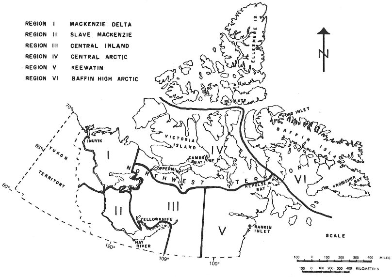
- SOR/78-720, s. 2
- SOR/81-468, s. 11
- SOR/91-428, s. 5
- SOR/98-388, s. 2
- SOR/2011-194, ss. 1 to 18
- SOR/2017-58, s. 4
SCHEDULE VI(Sections 28 and 29)
Sport Fishing Daily Catch and Possession Limits
| Item | Column I | Column II | Column III | Column IV |
|---|---|---|---|---|
| Species of Fish | Waters | Daily Catch Limit | Possession Limit | |
| 1 | Arctic char |
|
|
|
|
|
| ||
|
|
| ||
|
|
| ||
|
|
| ||
|
|
| ||
|
|
| ||
|
|
| ||
| 2 | Arctic grayling |
|
|
|
|
|
| ||
|
|
| ||
| 3 | Brook trout | All waters of the Northwest Territories | 3 | 5 |
| 4 | Bull trout | All waters of the Northwest Territories | 2 | 3 |
| 5 | Burbot | All waters of the Northwest Territories | 5 | 10 |
| 6 | Ciscoes | All waters of the Northwest Territories | 350 | 350 |
| 7 | Dolly Varden | All waters of the Northwest Territories | 4 | 7 |
| 8 | Goldeye | All waters of the Northwest Territories | 5 | 10 |
| 9 | Inconnu |
|
|
|
|
|
| ||
| 10 | Lake trout |
|
|
|
|
|
| ||
|
|
| ||
| 11 | Northern pike |
|
|
|
|
|
| ||
|
|
| ||
| 12 | Rainbow trout | All waters of the Northwest Territories | 3 | 5 |
| 13 | Suckers (all species) | All waters of the Northwest Territories | no limit | no limit |
| 14 | Walleye |
|
|
|
|
|
| ||
| 15 | Lake, Broad and Round Whitefish | All other waters of the Northwest Territories | 10 | 20 |
- SOR/78-369, s. 4
- SOR/79-485, s. 13
- SOR/81-119, s. 12
- SOR/85-713, s. 1
- SOR/88-256, ss. 1, 2
- SOR/91-428, s. 6
- SOR/91-481, s. 7
- SOR/2004-38, s. 6
- SOR/2005-108, s. 6
SCHEDULE VII(Subsection 5(7))
Close Times
| Item | Column I | Column II | Column III | Column IV |
|---|---|---|---|---|
| Waters | Species of Fish | Close Time | Method of Fishing | |
| 1 | Providence Creek (Latitude 61°15′N., Longitude 117°34′W.) | All species | April 15 — May 30 | Sport fishing |
| 2 | Yellowknife River between Prosperous Lake (Latitude 62°39′N., Longitude 114°15′W.) and Bluefish Lake | All species | September 1 — September 30 | Sport fishing |
| 3 | [Repealed, SOR/2009-83, s. 2] | |||
| 4 | The waters found in that portion of the Mackenzie River Delta set out in Area VI of Part II of Schedule II | All species | August 1 — August 31 | Gillnets |
| 5 | Mosquito Creek and the waters of Great Slave Lake within 1 km of the mouth of Mosquito Creek at 62°42′N., 116°04′W. | All species | May 1 — June 30 | Sport fishing |
| 6 | Sylvia Grinnell Lake and Sylvia Grinnell River and their tributaries and the waters of Frobisher Bay within 8 km of the mouth of the Sylvia Grinnell River at 63°44′N., 68°34′W. | All species | June 1 — June 30 | Gill nets |
| 7 | Rat River (Latitude 67°43′35″N., Longitude 136°15′39″W.), Husky Channel between Latitude 67°36′52″N., Longitude 134°51′30″W. and Latitude 68°08′03″N., Longitude 135°16′14″W. and Peel Channel between Latitude 68°07′51″N., Longitude 135°16′9″W. and Latitude 68°13′2″N., Longitude 135°05′35″W. | All species | August 7 — September 15 | Sport fishing |
| 8 | Baker Creek (Latitude 62°29′10″N., Longitude 114°21′36″W.) | All species | April 15 — June 15 | Sport fishing |
- SOR/81-119, s. 13
- SOR/82-425, s. 1
- SOR/87-508, s. 6
- SOR/88-256, s. 3
- SOR/91-447, s. 3
- SOR/2009-83, ss. 2, 3
- SOR/2012-185, s. 1
SCHEDULE VIII(Subsection 2(1) and paragraphs 27(2)(a) and 38(4)(a))Special Management Areas
1 Great Bear Lake, including all of Camsell River upstream to White Eagle Falls and all other tributary streams to Great Bear Lake from their mouths to 1 km upstream
- SOR/91-481, s. 8
Page Details
- Date modified: